- Glassan
Infobox Irish Place
name = Glasson
gaeilge = Glasân
map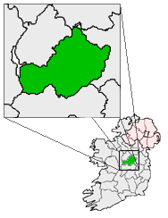
pin coords = left: 23px; top: 78px
north coord = 53.5553
west coord = 7.7700
irish grid =
elevation = 56 m
province =Leinster
county =County Westmeath
town pop =
rural pop =
census yr = 2006
web = www.westmeathcoco.ie/Glassan, also spelled Glasson (Irish: "Glasán" meaning: Streamlet), is a small village of 216 inhabitants (2002
census ) situated in ruralCounty Westmeath ,Ireland , km to mi | 10 | abbr=yes | precision=0 north ofAthlone , on the N55national secondary road , not far from the shores ofLough Ree . A small river known as theRiver Tullaghan flows through the northern end of the village and then flows south toKillinure Lough , a part of Lough Ree.The core of the village consists of a late 18th/early 19th century terrace of two storey rose-covered houses. Significant suburban development has taken place on all approaches to the village in recent times. The village is overlooked byCaraun Hill , particularly so when approaching the village from the direction of Lough Ree. Services and businesses in the village include two pubs(Grogan's and Farrell's) both with restaurants, a restaurant in the Old Garda barracks,, a hairdressers', a Garda Station, coffee shop/arts centre, car sales garage, panelbeaters workshop, two redundant Forges, a heritage/Community centre (Old School House), bus repair garage, service station and supermarket, a number of B&B's, a precast and ready-mix Concrete Works, a stonemasons workshop, a defunctpetty sessions court house, a formerRoyal Irish Constabulary barracks, a dispensary operated by theHealth Board , a house which was formerly a mid terrace church, (steeple extant but not in situ), and a fake water pump installed by the Tidy Towns' (Ignoring the previous location of several original pumps in the village which were robbed in recent years-they had logically been located over wells).Glassan also hoasts 2 hunts mainly the Glassan Farmers Hunt and the South Westmeath Harriers.ee also
Wikimedia Foundation. 2010.