- Japan National Route 6
-
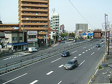
National Route 6 国道6号 (Kokudō Roku-gō) Route information Length: 345.5 km (214.7 mi) Highway system  Route 6 at Yotsugi, Katsushika, Tokyo
National Route 6 is a Japanese highway which goes from Tokyo via Mito and Hitachi in Ibaraki Prefecture towards Sendai. The route traces the old Mito Kaidō from Tokyo to Mito.[1][2] For much of its length it parallels the Jōban railway line and the Joban expressway.
Contents
Route Data
- Length: 345.5 km (214.7 mi)
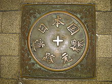
- Origin: Nihonbashi, Chūō, Tokyo (originates at the origins of Routes 1, 4, 14, 15, 17 and 20)
- Terminus: Miyagino-ku, Sendai (ends at Nigatake IC, junction with Route 45, the origin of Route 47)
- Major cities: Matsudo, Kashiwa, Toride, Ryugasaki, Tsuchiura, Ishioka, Mito, Hitachi, Iwaki, Soma
Overlapping sections
- In Chuo-ku, from the origin to Muromachi intersection: Route 17
- In Chuo-ku, from the origin to Honchō 3-chōme intersection: Route 4
- In Chuo-ku, from the origin to Asakusa-bashi intersection: Route 14
- From Kashiwa City to Toride City: Route 294
- In Tsuchiura City: Route 125 and Route 354
- In Ishioka City: Route 355
History
- 1952-12-04 - First Class National Highway 6 (from Tokyo to Sendai)
- 1965-04-01 - General National Highway 6 (from Tokyo to Sendai)
External links
References
- ^ "一般国道6号". Ministry of Land, Infrastructure, Transport and Tourism. Kanto Regional Development Bureau. http://www.ktr.mlit.go.jp/honkyoku/road/jikoku/station/r006.html. Retrieved 2010-11-29.(Japanese)
- ^ Chiba Kokaidō Rekishi Sanpo. Ministry of Land, Infrastructure and Transport. Accessed December 28, 2007.
Categories:- National highways in Japan
- Japan road stubs
Wikimedia Foundation. 2010.


