Fejér (former county)

Fejér (former county)

Infobox Former Subdivision
native_name =
conventional_long_name = Fejér County
common_name = Fejér
subdivision = County
nation = the Kingdom of Hungary
p1 =
s1 =
year_start = 11th century
event_end =
year_end = 1946
date_end =


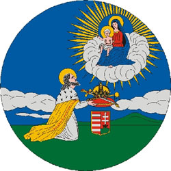
capital = Székesfehérvár
stat_area1 = 4129
stat_pop1 = 250600
stat_year1 = 1910
today = Hungary

Fejér (in Latin: "comitatus Albensis") is the name of a historic administrative county (comitatus) of the Kingdom of Hungary. Its territory, which was slightly smaller than that of present Fejér county, is presently in central Hungary. The capital of the county was Székesfehérvár.

Geography

Fejér county shared borders with the Hungarian counties Veszprém, Komárom, Pest-Pilis-Solt-Kiskun and Tolna. It lay south-west of Budapest, around Székesfehérvár. The river Danube formed most of its eastern border. Its area was 4129 km² around 1910.

History

Fejér county arose as one of the first comitatus of the Kingdom of Hungary, in the 11th century. The Solt region, east of the Danube river, which used to be part of Fejér county, went to Pest-Pilis-Solt county in the 17th century.

After World War II the region south-east of Lake Balaton (around Enying), which used to be in Veszprém county, went to Fejér county. The city of Érd and its surroundings went to Pest county.

Demographics

Ethnic groups (1891):
* Hungarians (Magyars): 190,660 (85.7%)
* Germans: 26,077 (11.7%)
* Slovaks: 2924 (1.3%)
* Serbs: 2103 (0.9%)Total population: 222,445

ubdivisions

In the early 20th century, the subdivisions of Fejér county were:


Wikimedia Foundation. 2010.

Игры ⚽ Поможем написать курсовую

Look at other dictionaries:

  • Veszprém (former county) — Infobox Former Subdivision native name = conventional long name = Veszprém County common name = Veszprém subdivision = County nation = the Kingdom of Hungary p1 = s1 = year start = 11th century event end = year end = 1946 date end = capital =… …   Wikipedia

  • Tolna (former county) — Infobox Former Subdivision native name = Tolna Vármegye conventional long name = Tolna County common name = Tolna subdivision = County nation = the Kingdom of Hungary p1 = s1 = year start = 11th century event end = Treaty of Trianon year end =… …   Wikipedia

  • Fejér County — Infobox Hungarian county name =Fejér region =Central Transdanubia seat = Székesfehérvár area = 4359 population = 426,541 density = 98 cities = 108: For the historical county see Fejér (former county). : For the mathematician of the same name see… …   Wikipedia

  • Tolna County — For other uses, see Tolna (disambiguation). Tolna County Coat of arms …   Wikipedia

  • Nógrád County — Salgótarján, seat of Nógrád …   Wikipedia

  • Csongrád County — This article is about the county. For the town see Csongrád. For the historical comitatus see Csongrád (former county). Csongrád County Coat of arms …   Wikipedia

  • Zala County — For other uses, see Zala (disambiguation). Zala County Coat of arms …   Wikipedia

  • Pest County — Infobox Hungarian county name =Pest region =Central Hungary seat = Budapest area = 6394 population = 1,077,300 density = 168 cities = 186Pest County (IPA2|pɛʃt) is a county ( megye ) in central Hungary. It covers an area of 6394 km², and has a… …   Wikipedia

  • Veszprém (county) — Infobox Hungarian county name =Veszprém region =Central Transdanubia seat = Veszprém area = 4613 population = 375,000 density = 81 cities = 217: For the historical county see Veszprém (former county). Veszprém (in Slovak Vesprím ) is the name of… …   Wikipedia

  • Borsod-Abaúj-Zemplén County — Coat of arms …   Wikipedia

Share the article and excerpts

Direct link
Do a right-click on the link above
and select “Copy Link”