- San Cristóbal de las Casas
Infobox Settlement |official_name = San Cristóbal de las Casas, Chiapas
nickname = "Jovel" or "Hueyzacatlán"
website = http://www.sancristobal.chiapas.gob.mx/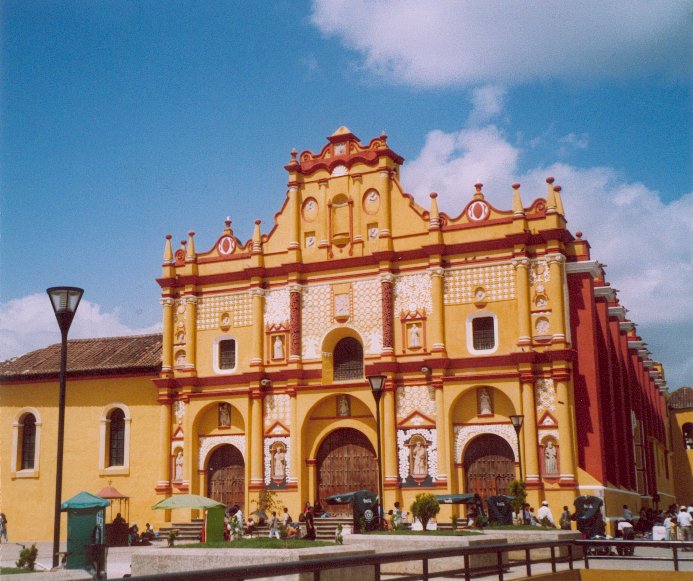
image_
map_caption = Chiapas, in brown; San Cristóbal de las Casas, in red
subdivision_type =State
subdivision_name =Chiapas
leader_title = Presidente municipal
leader_name = Sergio Lobato García
area_magnitude =
area_total_sq_mi = 186.87
area_total_km2 = 484.00
area_land_sq_mi =
area_land_km2 =
area_water_sq_mi =
area_water_km2 =
area_water_percent =
population_as_of = 2005 census
population_total = 142,364 city; 166,460 municipality
population_urban =
area_urban_km2 = 484.00
area_urban_sq_mi =
population_metro =
population_density_km2 =
population_density_sq_mi =
timezone = CST
utc_offset = -6San Cristóbal de las Casas is a municipality ("municipio") and
city in the central highlands of the Mexican state ofChiapas . It is located in the Highlands of Chiapas at coord|16.75|N|92.63|W, at an elevation of approximately 2100 m (6890 ft)above mean sea level . The city was named afterBartolomé de Las Casas , a Spanish priest who defended the rights of the Native Americans and was the firstbishop of Chiapas. In the 2005 census the city’s population was 142,364 people, whereas the municipality’s total was 166,460. It is the third-largest community in Chiapas, afterTuxtla Gutiérrez andTapachula . The municipality’s area is 484.00 km² (186.87 sq mi).San Cristóbal de las Casas was named a "
Pueblo Mágico " in 2003.History
ettlement and name
For thousands of years,
Maya peoples , ancestral to the present-day Tzotzil and Tzeltal peoples, have continuously lived in settlements in the general area of the modern city of San Cristóbal.In 1528, the Spanish "
conquistador ",Diego de Mazariegos established the settlement of "“Villareal de Chiapa de los Españoles”" as a regional base after defeating theZoque s andChiapanec os in fierce fighting. The settlement became the capital of the province of Chiapas. OnMarch 1 ,1535 , the Spanish crown bestowed the settlement with "un escudo de armas" and renamed the city, "“San Cristóbal de los Llanos”" after itspatron saint ,St. Christopher . The settlement was given the title of "city" onJuly 7 ,1536 , and once again renamed to "“Ciudad Real de Chiapa”". By 1577, the city selected don Juan de Meza as its firstmayor .The city’s name underwent frequent modifications. On
July 27 ,1829 the city became "“Ciudad de San Cristóbal”" and it was onMay 31 ,1848 that they city became know as "“San Cristóbal de Las Casas”", in honor ofBartolomé de Las Casas . OnFebruary 13 ,1934 , the city became "“Ciudad Las Casas”", but this was officially reverted to "“San Cristóbal de Las Casas”" onNovember 4 ,1943 by Dr. Rafael Pascacio Gamboa. Despite the name changes, the local people continue to call the city by its traditional name, "“Jovel”". (During the colonial period, the city was also known as "“La Chiapa de los Españoles”" and until a few decades ago, it was also known as "“Hueyzacatlán”".)Zapatista conflict
San Cristóbal was one of the four cities that the
Zapatista Army of National Liberation took in its uprising in January 1994. While many people in San Cristóbal, who consider themselves traditionally rooted here (called "Coletos") are very much against the Zapatistas, there are also parts of the population (poor, civil society) that sympathize or openly cooperate with the Zapatista movement. Many tourists are interested in the Zapatista movement. In 2006, the latest political initiative of the Zapatistas, theOther Campaign started from San Cristóbal at the beginning of the year. The Zapatistas are omnipresent in the tourist markets (selling e.g. dolls, posters, t-shirts) in the city.Demographics
San Cristobal is estimated to have about 200,000 inhabitants. This number has been increasing steadily in the past years, since many rural people have been displaced by the armed conflict in 1994 and the subsequent
low-intensity warfare of the Mexican government.The city is located near theTzotzil Maya communities ofChamula , andZinacantán , and a half-day bus ride from the Classic Maya ruins ofPalenque , and is therefore a popular base of operations for tourists from all over the world looking to experience ancient and modern Maya culture.Religion
The city is mostly Catholic with many different Protestant churches and nearly 300
Muslims as of 2000.fact|date=March 2008 Like many isolated areas with high indigenous populations, the Catholic faith is often mixed with many native beliefs.Media
San Cristóbal de Las Casas has from several years ago a couple of radio stations broadcasting at AM,
XEWM-AM andXERA-AM . The XEWM station can be heard live from the [http://www.supremaradio.com Suprema Radio Group web page] .Natural environment
Surrounding San Cristóbal and even within the city there are several typical mountain
wetland s. They are home to an endemic fish (Profundulus hildebrandi ), commonly known as "popoyote " which only lives in the valley of San Cristóbal. The rivers are heavily contaminated. fact|date=September 2008 Contaminated with what?The valley of San Cristóbal is surrounded by several mountains. To the west, theHuitepec (about 2700m) is home to the Santa Anita holy site, where a Jesus appeared on a rock, and to a natural reserve with cloud forests.To the east, theCerro de la Santa Cruz is home to a church where on May 3rd of every year a procession takes place.To the north, theMoxviquil has a prehispanic archaeological site.The mountains around San Cristobal are heavily exploited for gravel. TheAgua Azul waterfall is close to the area as well.Along with a lack of urban planning and encroachment of the forested hills by migrants, this has led to an elevated danger of floods in the lower-lying areas of San Cristóbal. The valley of San Cristóbal does not have a natural opening towards the
Central Depression of Chiapas . The water used to disappear in a lake at the lowest point of the valley in the southern part of the city. In the 1970s a tunnel was built which now evacuates the water.Gallery
References
* [http://www.inegi.gob.mx/est/contenidos/espanol/sistemas/conteo2005/localidad/iter/ Tables of population data] from the 2005 census, from
INEGI , the national Mexican geography and statistics institute.External links
* [http://sancristobaldelascasas.chiapas.gob.mx/ Ayuntamiento de San Cristóbal de las Casas] Official website
* [http://www.nhavers.8k.com/mex1.htm Feature about San Cristóbal, including the church of San Juan Chamula and Sumidero Canyon]
* [http://www.supremaradio.com Suprema Radio Group webpage]
Wikimedia Foundation. 2010.