- Gatton, Queensland
Infobox Australian Place | type = town
name = Gatton
state = Queensland
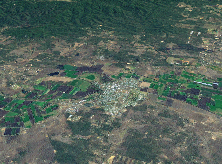
caption = ALandsat montage of Gatton township
lga =Lockyer Valley Regional Council
postcode = 4343
est =
pop = 6000
elevation=
maxtemp =
mintemp =
rainfall =
stategov =Electoral district of Lockyer
fedgov =Division of Blair
dist1 =
dir1 =
location1=.
The Gatton area was explored by Major
Edmund Lockyer in 1825. A settlement known as Gatton was gazetted in 1855. [cite web |url=http://www.heritageaustralia.com.au/search.php?state=QLD®ion=23&view=1098 |title=Historical Towns Directory |accessdate=2008-01-04 |format= |work=Australian Heritage ] The small village did not experience significant growth until the mid 1870's, after the railway to Grandchester attracted people to the area. [cite book |title=Heritage Trails of the Great South East |last=Queensland Environmental Protection Agency |first= |authorlink= |coauthors= |year=2000 |publisher=State of Queensland |location= |pages=62 |isbn=073451008X]The area is primarily agricultural, with vegetables making up the majority of crops. Fruit was grown extensively in the Shire until the 1990s, when economic conditions changed and many of the orchards were removed.
The
University of Queensland has a campus on the former Queensland Agricultural College site at Lawes, just to the east of the town of Gatton. This campus is now the base for much of the university's rural focused research and teaching.Over recent years, the rural tranquility of the Gatton Shire has started to be encroached on by the suburban sprawl of metropolitan
Brisbane and Ipswich in the east and Toowoomba in the west. TheWarrego Highway , which runs east-west through the Shire, has also experienced increasing strip development, with fuel outlets and commercial properties gradually spreading along the highway.Gallery

ee also
*
Gatton murders References
Wikimedia Foundation. 2010.