Talofofo, Guam

Talofofo, Guam

Infobox Settlement

settlement_type = Village
subdivision_type = Country
subdivision_name = United States

subdivision_type1 = Territory
subdivision_name1 = Guam
subdivision_type2 =
subdivision_name2 =

timezone=ChST
utc_offset=+10

unit_pref=Imperial
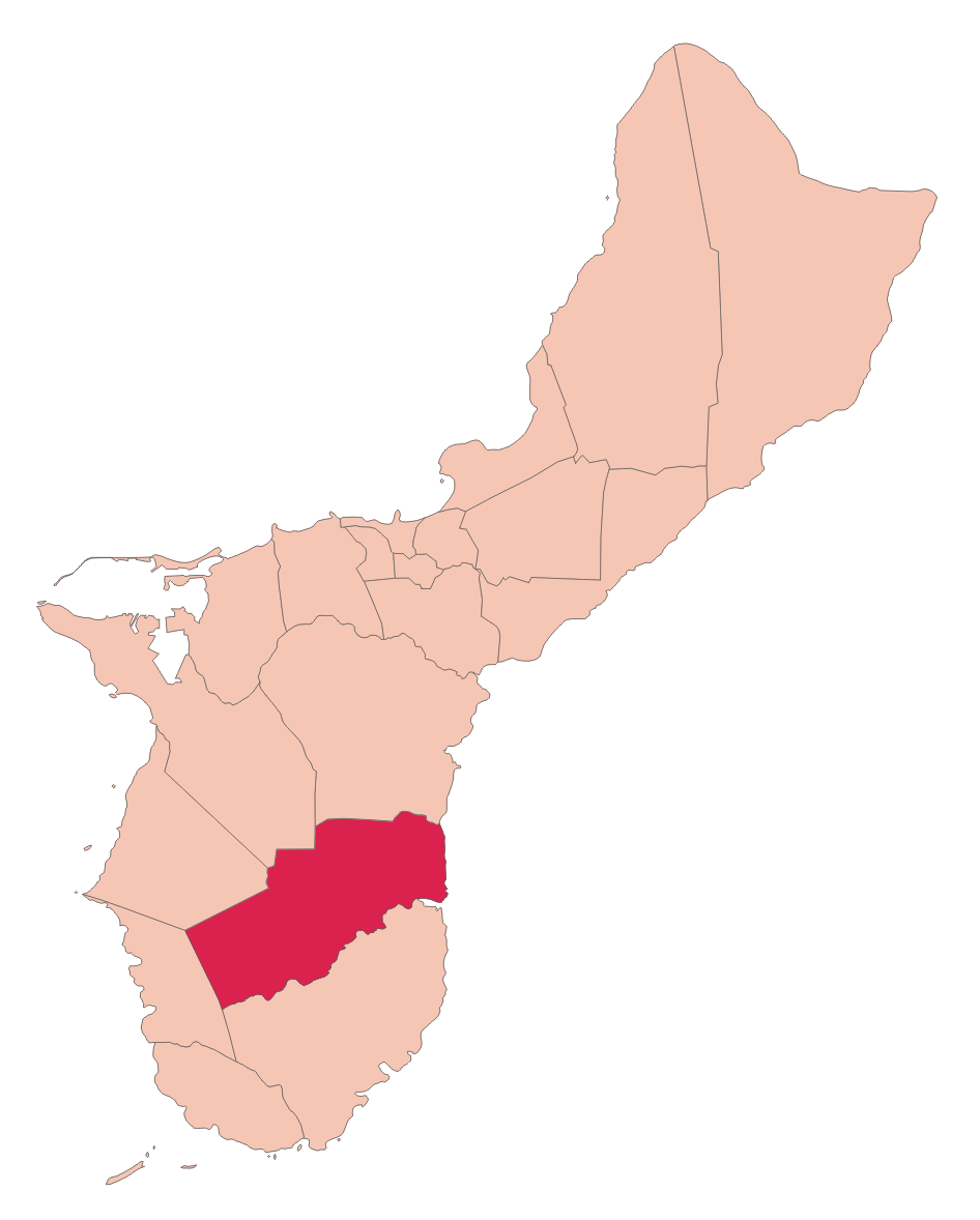
map_caption =Location of Talofofo within the Territory of Guam.
latd= |latm= |lats= |latNS=
longd= |longm= |longs= |longEW=
elevation_ft =
official_name = Talofofo


area_total_sq_mi =
population_total = 3215|population_footnotes=
population_as_of = 2000
population_blank1 =
leader_title=Mayor
leader_name =
Mayor_since =
leader_name1 =
blank_info =

Talofofo is a village located in the southern part of the American island of Guam on the east coast. The village center is located in the hills above the coast, while the smaller coastal community below the cliff is known as Ipan.

The village contains two golf courses. Other tourist attractions include Jeff's Pirate's Cove Restaurant and Museum, Talofofo Caves, Park, and Ipan Beach Resort and the Talofofo River boat cruise to an ancient Chamorro village. Japanese holdout from World War II Shoichi Yokoi was captured by Jesus Duenas and Manuel DeGracia near Talofofo on January 24, 1972 [http://ns.gov.gu/scrollapplet/sergeant2.html Shoichi Yokoi, police transcripts] , ns.gov.gu]

The village is located south of the village of Yona and north of Inarajan.

Education

Guam Public School System serves the island.

Talofofo Elementary School serves elementary school students. Southern High School in Santa Rita serves the village." [http://www.gdoe.net/ci/high_sch_crse_desc/guam_PHS.pdf Guam's Public High Schools] ." "Guam Public School System". Accessed September 8, 2008.]

Notre Dame High School, a private school, is in Talofofo.

Gallery

See also

* Villages of Guam

References and notes


Wikimedia Foundation. 2010.

Игры ⚽ Нужно решить контрольную?

Look at other dictionaries:

  • Guam Public School System — (GPSS, Chamorro: Sisteman Eskuelan Pupblekon Guåhan ), formerly the Guam Department of Education, is a school district that serves the entire island of Guam, a United States insular area. The school district can be thought of as analogous to the… …   Wikipedia

  • Guam — This article is about the United States island territory of Guam. For GUAM, an eastern European international organization, see GUAM Organization for Democracy and Economic Development. Guam Guåhan …   Wikipedia

  • Guam Highway 4 — Infobox road country=Guam route=4 highway name=Guam Highway 4 maint=Guam Department of Public Works length mi= length round= length ref= direction a=West starting terminus=Hwy 2 in Umatac junction=Hwy 4A in Talofofo Hwy 17 in Yona Hwy 10 in… …   Wikipedia

  • Talofofo Falls — The Talofofo Falls are a scenic series of cascades on the island of Guam. They are located in the southeast of the island, inland from Talofofo Bay.References*Bendure, G. Friary, N. (1988) Micronesia:A travel survival kit. South Yarra, VIC:… …   Wikipedia

  • Talofofo Bay — The Talofofo Bay is an inlet in the southeastern coast of the island of Guam at the mouth of the Talofofo River.References*Bendure, G. Friary, N. (1988) Micronesia:A travel survival kit. South Yarra, VIC: Lonely Planet …   Wikipedia

  • Talofofo Village — Original name in latin Talofofo Village Name in other language Pre WW2 Part of Inarajan, Talo fo fo State code GU Continent/City Pacific/Guam longitude 13.35513 latitude 144.75835 altitude 101 Population 3215 Date 2013 07 07 …   Cities with a population over 1000 database

  • Notre Dame High School (Guam) — For other schools of the same name, see Notre Dame High School (disambiguation). Notre Dame High School Address 480 S. San Miguel Street Talofofo, Guam …   Wikipedia

  • List of populated places in Guam — Guam This article is part of the series: Politics and government of Guam …   Wikipedia

  • Educación pública de Guam — Guam Public School System (en chamorro: Sisteman Eskuelan Pupblekon Guåhan), antiguamente el Departamento de educación de Guam, es un distrito escolar que sirve a la isla de Guam, una área insular perteneciente a los Estados Unidos de América. En …   Wikipedia Español

  • Geography of Guam — Guam Native name: Guåhån Map of Guam (See detailed map) …   Wikipedia

Share the article and excerpts

Direct link
Do a right-click on the link above
and select “Copy Link”