- Kviteseid
Infobox_Kommune
name=Kviteseid
idnumber=0829
county=Telemark
landscape=Vest-Telemark
capital=Kviteseid
governor=Torstein Tveito (Sp)
governor_as_of=2003
arearank=157
area=708
arealand=624
areapercent=0.22
population_as_of=2004
populationrank=296
population=2,622
populationpercent=0.06
populationdensity=4
populationincrease=-6.9
language=Nynorsk
demonym=Kvitseiding
lat_deg=59| lat_min=20| lat_sec=55| lon_deg=8| lon_min=29| lon_sec=34
utm_zone=32V| utm_northing=6579009 |utm_easting=0471159| geo_cat=adm2nd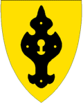
munwebpage=www.kviteseid.kommune.no
Kviteseid is a
municipal ity in the county ofTelemark ,Norway .The parish of "Hvideseid" was established as a municipality January 1, 1838 (see
formannskapsdistrikt ). The borders of the municipality are in the northwest toSeljord , east to Nome, south toDrangedal ,Nissedal andFyresdal and west toTokke . The highest point is Sveinsheia, 1,141 meters above sea level.The industries are
forestry ,agriculture ,tourism andhydroelectric power .Within the municipality of Kviteseid one finds the little village of
Morgedal , also known as "The Cradle of Modern Skiing" ("Skisportens vugge"), home ofSondre Norheim . Here, the olympic fire was lit for theOlympic Games in 1952 (Oslo ), 1960 (Squaw Valley ) and 1994 (Lillehammer ).Kviteseid is also known for being a stop in the
Telemark Canal .There are several
ski resort s in Kviteseid.Vrådal is one of them.The name
The Norse form of the name was "Hvítiseið". The first element is the genitive case of "*Hvítir" 'the white one' (probably an older name of
Kviteseidvatn ), the last element is "eið" n 'path between two lakes'.Until 1889 the name was written "Hviteseid".
Coat-of-arms
The coat-of-arms is from modern times (1987). It shows an old lock. (To symbolize safety.)
External links
* [http://www.kviteseidbyen.no Kviteseidbyen]
* [http://www.vraadal.com Vrådal.com]
* [http://www.morgedal.no Morgedal.no]
* [http://www.ssb.no/kommuner/region.cgi?nr=08 Kommunefakta Telemark (Statistisk Sentralbyrå)]
Wikimedia Foundation. 2010.