- Otternish
-
Coordinates: 57°41′53″N 7°11′35″W / 57.698°N 7.193°W
Otternish Scottish Gaelic: Otairnis 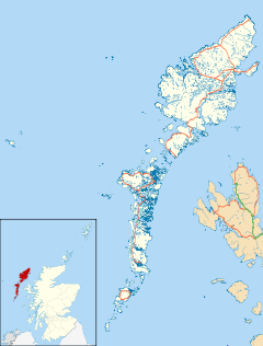
 Otternish
Otternish shown within the Outer HebridesOS grid reference NF906794 Council area Na h-Eileanan Siar Country Scotland Sovereign state United Kingdom Post town ISLE OF NORTH UIST Postcode district HS6 Dialling code 01876 Police Northern Fire Highlands and Islands Ambulance Scottish EU Parliament Scotland UK Parliament Na h-Eileanan an Iar Scottish Parliament Western Isles (Eilean Siar) List of places: UK • Scotland • Otternish is the former North Uist terminal for the ferry to Berneray.[1] The slipway lies 6 miles (10 km) north of Lochmaddy. When the causeway was completed in December 1998, the slipway was no longer needed. Ancient human remains were found here in 1870.[2]
Footnotes
- ^ "Otternish". Ports and Harbours of the UK. http://www.ports.org.uk/port.asp?id=484. Retrieved 13 September 2009.
- ^ "Otternish". Gazetteer for Scotland. http://www.scottish-places.info/towns/townfirst8842.html. Retrieved 14 September 2009.
Categories:- Villages in the Outer Hebrides
- Western Isles geography stubs

Wikimedia Foundation. 2010.