- Ostravice (river)
-
Ostravice River 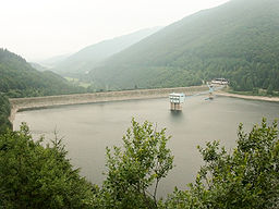
Named for: Ostrava City Country Czech Republic Region Moravian-Silesian Tributaries - left Čeladenka - right Morávka Settlements Ostravice, Frýdlant nad Ostravicí, Frýdek-Místek, Ostrava Primary source Bílá Ostravice - location Moravian-Silesian Beskids - elevation 900 m (3,000 ft) - coordinates 49°24′26″N 18°22′14″E / 49.40722°N 18.37056°E Secondary source Černá Ostravice - coordinates 49°29′52″N 18°32′33″E / 49.49778°N 18.5425°E Source confluence - coordinates 49°27′17″N 18°28′3″E / 49.45472°N 18.4675°E Mouth Oder River - location Ostrava - elevation 190 m (600 ft) - coordinates 49°52′10″N 18°17′1″E / 49.86944°N 18.28361°E Length 64 km (40 mi) Basin 827 km2 (319 sq mi) Discharge - average 12.7 m3/s (448 cu ft/s) - max 933 m3/s (32,949 cu ft/s) 

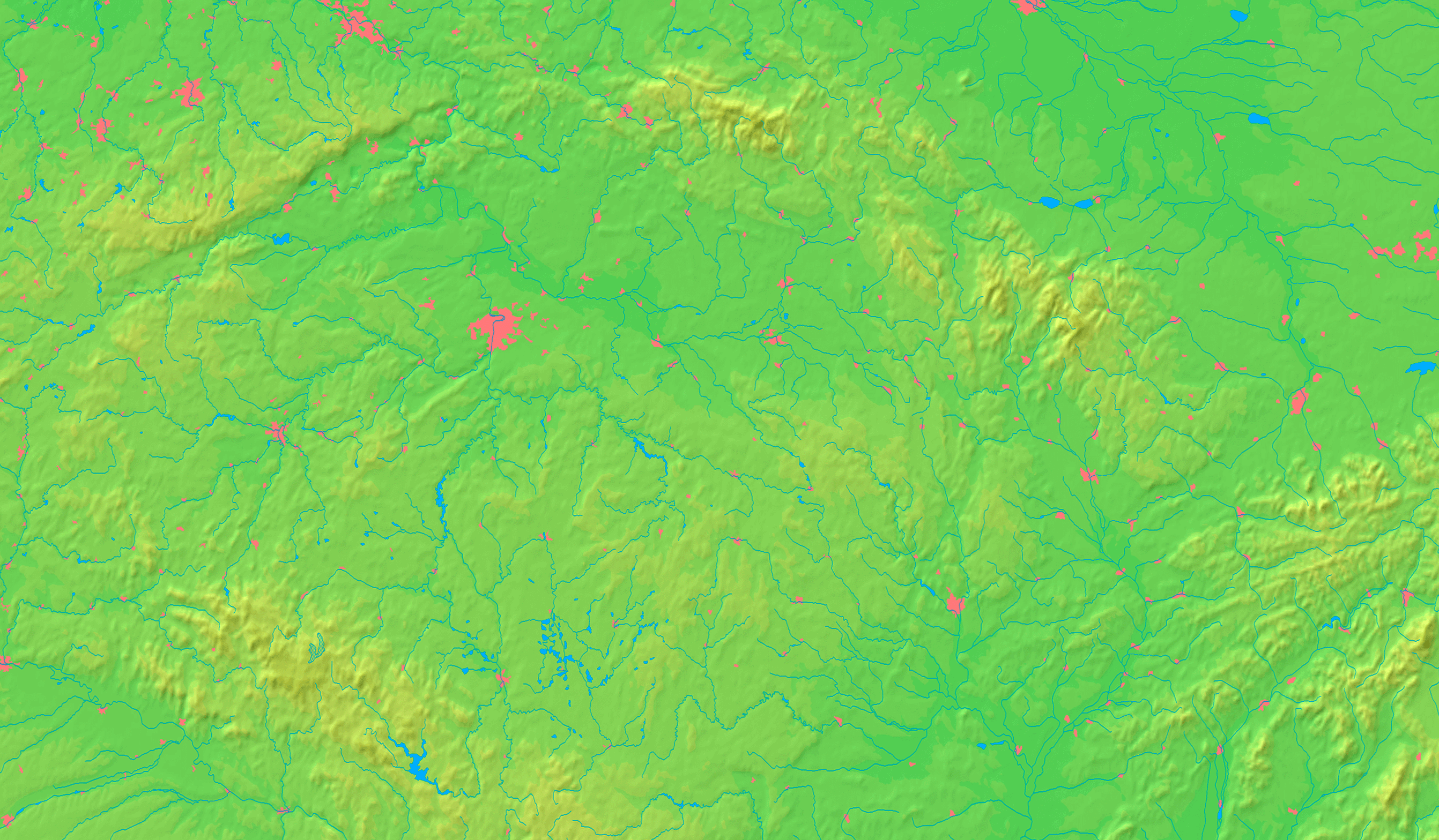
 The Ostravice from its two sources until its confluence with the Oder (magenta) and its watershed
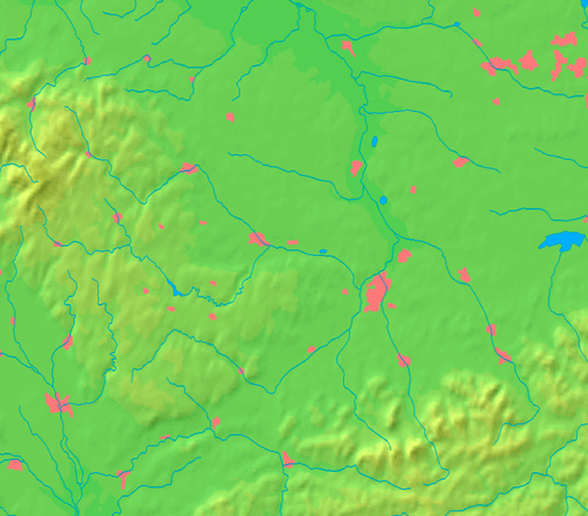
 Location of Ostravice in the Moravian-Silesian Region
Ostravice (Polish: Ostrawica, German: Ostrawitza) is a river in Moravian-Silesian Region, Czech Republic. It originates in the Moravian-Silesian Beskids and then flows through Ostravice, Frýdlant nad Ostravicí, Frýdek-Místek and Paskov to Ostrava where it enters the Oder as its right tributary. It partly forms the border between historical regions Moravia (left bank) and Silesia (more precisely Cieszyn Silesia) (right bank).
The river starts as the Ostravice after the confluence of the Bílá Ostravice (i.e., White Ostravice, considered its main source) and the Černá Ostravice (i.e. Black Ostravice). They are both streams flowing through deeply forested valleys which are important access roads to the resorts of Bílá and Bílý Kříž. Ostravice then creates a fresh water reservoir behind Šance Dam, for the industrial region around Ostrava finished in 1970. It has an area of 335 km2 (129 sq mi) and a 65 m (213 ft) high and 342 m (1,122 ft) long rockfill dam.
The Ostravice then flows through the rolling hills region between Ostravice and Frýdek-Místek and finally through the lowlands of the highly industrial Ostrava basin.
References
- Ludvík, Marcel (1987). Beskydy, Turistický průvodce ČSSR. Praha: Olympia. 27-031-87.
- Rohlík, Jiří (2001). Moravskoslezské Beskydy, Soubor turistických map 1:50 000. Praha: TRASA, s.r.o.. ISBN 80-85999-29-3.
- "Těšínsko z pohledu fyzické geografie". Muzeum Těšínska. http://www.muzeumct.cz/tesin/tradice/fizicka.php. Retrieved 2007-01-14.
Categories:- Rivers of the Moravian-Silesian Region
- Moravian-Silesian Beskids
- Frýdek-Místek District
- Oder basin
- Cieszyn Silesia


Wikimedia Foundation. 2010.