- Osowiec-Twierdza
-
Osowiec-Twierdza — Village — Coordinates: 53°28′25″N 22°39′26″E / 53.47361°N 22.65722°E Country  Poland
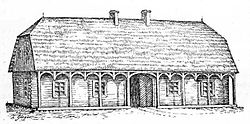
Voivodeship Podlaskie County Mońki Gmina Goniądz Population 630  Osowiec. Pub of the eighteenth century illustration Zygmunt Gloger, "Encyclopedia of Old Polish"
Osowiec-Twierdza [ɔˈsɔvjɛt͡s] is a village in the administrative district of Gmina Goniądz, in Mońki County, Podlaskie Voivodeship, in north-eastern Poland.[1] It lies approximately 5 kilometres (3 mi) south of Goniądz, 11 km (7 mi) north-west of Mońki, and 51 km (32 mi) north-west of the regional capital Białystok. Osowiec-Twierdza is home to the Biebrza National Park.
History
Excavations have revealed settlements in Osowiec from prehistoric times. Okrasa existed as a village since before 1444 AD. In 1743 to 1827 Osowiec (as Marcinpol) was a city. In the nineteenth century, a railway line was built from Białystok to Ełk, [Königsberg]], and passing through Osowiec. From 1882 to 1892, the Russian army built a regional military defense strategy.
Further work built fortifications at the outbreak of World War I. From 1914 to August 6, 1915, the German 8th Army futilely struggled to break the defensive belt represented by Osowiec Fortress, which successfully defended the Tsarist troops. During the fighting, the German army used gas (chlorine), which killed about 2 000 of the Tsar's troops. Finally, due to an unfavorable strategic situation at the front, the Russian troops left the fort at the end of August 1915. The defense of Osowiec is comparable to the 1916 battle of Verdun, in France. Both towers (fortress) ware never captured. In the Second World War, there was no struggle for Osowiec.
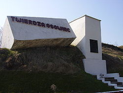
Today some parts of the fortress are accessible to tourists, especially within the boundaries of Biebrza National Park. The visitor information center of the park is located in Osowiec-Twierdza [2], a small settlement located within the boundaries of the fortress. The village has a population of 630. It is most famous for its 19th-century Osowiec Fortress.
Gallery
References
- ^ "Central Statistical Office (GUS) – TERYT (National Register of Territorial Land Apportionment Journal)" (in Polish). 2008-06-01. http://www.stat.gov.pl/broker/access/prefile/listPreFiles.jspa.
- ^ Lonely Planet guidebook Poland [1]
Coordinates: 53°28′25″N 22°39′26″E / 53.473611°N 22.657222°E
Town and seat 
Villages Białosuknia · Budne · Budne-Żarnowo · Dawidowizna · Doły · Downary · Downary-Plac · Klewianka · Kramkówka Duża · Kramkówka Mała · Krzecze · Łazy · Mierkienniki · Olszowa Droga · Osowiec · Osowiec-Twierdza · Owieczki · Piwowary · Płochowo · Smogorówka Dolistowska · Smogorówka Goniądzka · Szafranki · Uścianek · Wojtówstwo · Wólka Piaseczna · Wroceń
Categories:
Wikimedia Foundation. 2010.


