- Ortenburg (Bavaria)
-
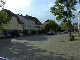
Ortenburg (Bavaria) Ortenburg town centre 
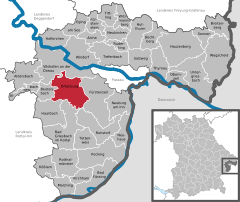
Coordinates 48°32′N 13°13′E / 48.53333°N 13.21667°ECoordinates: 48°32′N 13°13′E / 48.53333°N 13.21667°E Administration Country Germany State Bavaria Admin. region Lower Bavaria District Passau Mayor Hans Halser (Überparteiliche Wählergemeinschaft) Basic statistics Area 60.73 km2 (23.45 sq mi) Elevation 358 m (1175 ft) Population 7,064 (31 December 2010)[1] - Density 116 /km2 (301 /sq mi) Other information Time zone CET/CEST (UTC+1/+2) Licence plate PA Postal code 94496 Area code 08542 Website www.ortenburg.de Ortenburg is a municipality and old market town in the district of Passau in Bavaria in Germany.
History
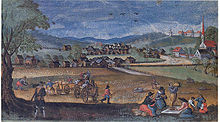
Set in the Wolfach River valley, Ortenburg can look back over a 900 year history. In about 1120 it was established by the Princes of Ortenburg. At the same time the upwardly mobile von Kamm family appeared on the scene. However, during the thirteenth century the von Kamms relocated to Hals (now a quarter of Passau). The Ortenburg princes, whose own origins lay with the Spanheimer dynasty, were keen to establish their own separate dynastic centre and it was this Imperial immediacy (commercially privileged territory) which became the principality of Ortenburg.
The Ortenburgs were among the most powerful of the Bavarian nobility, competing in terms of power and position with the Wittelsbach dynasty. During the height of their power, during the twelfth and thirteenth centuries, the Ortenburgs held lands from as far south as the Brixen valley, that extended also far into the Upper Palatinate.
Aicha vorm Wald · Aidenbach · Aldersbach · Bad Füssing · Bad Griesbach · Beutelsbach · Breitenberg · Büchlberg · Eging am See · Fürstenstein · Fürstenzell · Haarbach · Hauzenberg · Hofkirchen · Hutthurm · Kirchham · Kößlarn · Malching · Neuburg am Inn · Neuhaus am Inn · Neukirchen vorm Wald · Obernzell · Ortenburg · Pocking · Rotthalmünster · Ruderting · Ruhstorf an der Rott · Salzweg · Sonnen · Tettenweis · Thyrnau · Tiefenbach · Tittling · Untergriesbach · Vilshofen · Wegscheid · Windorf · Witzmannsberg
References
- ^ "Fortschreibung des Bevölkerungsstandes" (in German). Bayerisches Landesamt für Statistik und Datenverarbeitung. 31 December 2010. https://www.statistikdaten.bayern.de/genesis/online?language=de&sequenz=tabelleErgebnis&selectionname=12411-009r&sachmerkmal=QUASTI&sachschluessel=SQUART04&startjahr=2010&endjahr=2010.
Categories:- Geography articles needing translation from German Wikipedia
- Municipalities in Bavaria
- Passau district
- Lower Bavaria geography stubs
Wikimedia Foundation. 2010.


