- Old Annapolis Road, Nova Scotia
-
The Old Annapolis Road was a planned direct route between Halifax and Annapolis Royal, the current and former capitals of Nova Scotia, in Eastern Canada. Work began in 1784, but the road was never completed, though sections remain in use today.
Contents
Historical context
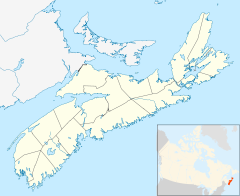
 Annapolis RoyalHalifaxNew Ross
Annapolis Royal was the original colonial capital of Nova Scotia, until the founding of Halifax in 1749.[1] Nevertheless in the late 18th century it was an important commercial center and vital to the economy of the colony. It was also the principle gateway to New Brunswick by sea.[2] Transportation between the two cities was by a lengthy and indirect route of early roads, following ancient trails from Halifax to Windsor, and then West through roads linking the Acadian settlements of the Annapolis Valley. Approximately the same route is followed by Nova Scotia Highway 101 today.
Work began on surveying a new road from Halifax to Annapolis Royal as early as 1776. In 1784 a new survey was conducted to plan a new route through the wilderness between the two cities, with the intention of reducing travel time - particularly for the movement of troops - and opening up the land for settlement.[3]
Geography
The interior of Nova Scotia consists of thick forest and extensive swamps, and in the early 19th century was an uninhabited wilderness. The route of the road was varied to make areas of potentially-better farmland more accessible.
Construction
Road building commenced in 1784. After a few miles had been constructed at the Western (Annapolis Royal) end of the road, work ceased until 1816. When it resumed, considerable progress was made in the West, with the road reaching Sherbrooke - today known as New Ross[4] - approximately halfway along the intended route. East of Sherbrooke, the hostile terrain proved too difficult and construction halted.[3]
Some construction was completed at the Halifax end, where the road joined today's Bedford Highway near Kearney Lake.[5]
The road today
Sections of the road are in use as parts of the road from Annapolis Royal to New Ross, which follows approximately the same route as that surveyed in 1784[6] . Sections of the Eastern construction still exist, as logging roads and trails,[7] and in the alignment of several local road segments.
References
- ^ Orkin, David (2010). Nova Scotia. Bradt Travel Guides. p. 200. ISBN 9781841622828. http://books.google.com/books?id=wseVF7rMyc4C&pg=PA200&dq=halifax+capital+%22annapolis+royal%22&hl=en&ei=woJ5TJOkKMqgnQeRqM33AQ&sa=X&oi=book_result&ct=result&resnum=1&ved=0CCQQ6AEwADgK#v=onepage&q=halifax%20capital%20%22annapolis%20royal%22&f=false.
- ^ Dawson, Joan (2009). Nova Scotia's Lost Highways - The Early Roads That Shaped the Province. Nimbus Publishing Ltd. p. 80. ISBN 9781551097329.
- ^ a b Dawson, Joan (2009). Nova Scotia's Lost Highways - The Early Roads That Shaped the Province. Nimbus Publishing Ltd. p. 86. ISBN 9781551097329.
- ^ Brown, Thomas J (2008). Place-Names Of The Province Of Nova Scotia. READ BOOKS. p. 104. ISBN 9781408691045. http://books.google.com/books?id=pCHr8QXh7gEC&pg=PA104&dq=sherbrooke+%22new+ross%22&hl=en&ei=0I55TMDmJMfanAfg2vGdCw&sa=X&oi=book_result&ct=result&resnum=2&ved=0CCoQ6AEwAQ#v=onepage&q=sherbrooke%20%22new%20ross%22&f=false.
- ^ Sanders, Mike; Beanlands, SSara (August 2009). "Highway 113 Archaeological Assessment". Nova Scotia Transportation and Infrastructure Renewal. http://www.gov.ns.ca/nse/ea/highway113/Hwy113.2009.EA.Report.Appendix_C_Text.pdf. Retrieved 29 December 2010.
- ^ Dawson, Joan (2009). Nova Scotia's Lost Highways - The Early Roads That Shaped the Province. Nimbus Publishing Ltd. p. 88. ISBN 9781551097329.
- ^ Wharton, Danielle. "Wilderness Walks in Nova Scotia - The Old Annapolis Road Pocket Wilderness". Outdoors NS. http://www.outdoorns.com/features/wilderness.htm. Retrieved 28 August 2010.
Categories:- Roads in Nova Scotia
- History of Nova Scotia

Wikimedia Foundation. 2010.