- Ōjima Station
-
Ōjima Station大島駅
Ōjima Station platforms Location Prefecture Tokyo
(See other stations in Tokyo)Ward Kōtō Neighborhood etc. 5-10-8 Ōjima (in Japanese) 東京都江東区大島5-10-8 History Year opened 1978 Rail services Station number(s) S-15 Operator(s) Tokyo Metropolitan Bureau of Transportation (Toei) Line(s) Toei Shinjuku Line Statistics 30,044 passengers/day [1]  There is a bus stop near this station
Ōjima Station (大島駅 Ōjima-eki) is a railway station in Kōtō, Tokyo, Japan. Its station number is S-15. The station opened on December 21, 1978.
Contents
Platforms
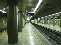
Ōjima Station consists of two island platforms served by three tracks.
1 ○Toei Shinjuku Line for Shinjuku, Sasazuka, Hashimoto 2 ○Toei Shinjuku Line for Shinjuku, Sasazuka, Hashimoto
(used for waiting for passing expresses or terminating trains)3 ○Toei Shinjuku Line Motoyawata
(used for waiting for passing expresses or terminating trains)4 ○Toei Shinjuku Line Motoyawata Surrounding area
The station is located underneath Tokyo Metropolitan Route 50 (Shin-Ōhashi-dōri) near its intersection with Tokyo Metropolitan Route 476 (Kyūhachi-dōri). The Shuto Expressway's No. 7 Komatsugawa Line is half a kilometer to the north. The area is a mix of commercial, residential, and light industrial.
Connecting bus service
Toei Bus: Ōjima-Ekimae
- Kusa 24: for Asakusa-Kotobukichō
- Kame 24: for Kasaibashi; via Nishi-Ōjima Station for Kameido Station
- Kame 21: for Tōyōchō Station; via Suijinmori for Kameido Station
Line
Adjacent stations
« Service » Toei Shinjuku Line Nishi-Ōjima Local Higashi-Ōjima Morishita Express Funabori References
- ^ "Ōjima Station information" (in Japanese). Tokyo Metropolitan Bureau of Transportation. http://www.kotsu.metro.tokyo.jp/subway/stations/ojima/s17.html. Retrieved February 2010.
External links
Stations of the Toei Shinjuku Line (through to Sasazuka, Hashimoto -) Shinjuku - Shinjuku-sanchōme - Akebonobashi - Ichigaya - Kudanshita - Jimbōchō - Ogawamachi - Iwamotochō - Bakuro-yokoyama - Hamachō - Morishita - Kikukawa - Sumiyoshi - Nishi-ōjima - Ōjima - Higashi-ōjima - Funabori - Ichinoe - Mizue - Shinozaki - Motoyawata
Coordinates: 35°41′24″N 139°50′08″E / 35.689885°N 139.835641°ECategories:- Railway stations in Tokyo
- Railway stations opened in 1978
- Stations of Tokyo Metropolitan Bureau of Transportation

Wikimedia Foundation. 2010.