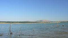
- Ogosta Reservoir
-
Ogosta lake
Язовир Огоста
Location Montana Coordinates 43°22′31″N 23°10′56″E / 43.37528°N 23.18222°ECoordinates: 43°22′31″N 23°10′56″E / 43.37528°N 23.18222°E Lake type reservoir Primary inflows Ogosta, Burzia and Zlatitsa rivers Catchment area 948 km² Basin countries Bulgaria Surface area 2360 ha Ogosta (Bulgarian: Язовир Огоста) is a lake in the North West of Bulgaria. It is the second largest artificial lake in Bulgaria and The Balkan Peninsula and one of the biggest in Europe. It collects the waters of the rivers Ogosta, Burzia and Zlatitsa and is located about 600 meters to the south-west of the border of Montana city and 60 m. above the level of the city. The water collecting basin is with area of 948 km2 and the area of the lake itself is 24 hectares. The average water volume is 384 Mm3 and the overall volume 506Mm3.
The construction of the lake took 20 years and was completed in 1986. For its construction two villages were flooded (Jivovtsi and Kalimanitsa) and their inhabitants relocated to Berkovitsa and Montana.
This hydro-technical outfit was erected for the purpose of irrigation of large areas of agricultural land situated from Montana to Zlatia (near Lom), but until 1989 only half of the pipe infrastructure was developed and it was never completed.
Now days the waters of the lake are not used for irrigation, but for electricity production in two hydro-electric power-stations: “Kosharnik” and “Ogosta” situated by the dam.
In 1999 the lake was designated for commercial fishing. The diversity of fish is significant: carp, carassius, rudd, carp bream, European perch, common nase and barbus.
References
- Translated from Огоста (язовир) in the Bulgarian Wikipedia.
Categories:- Reservoirs and dams in Bulgaria
- Montana Province
Wikimedia Foundation. 2010.
