Odeleite (Castro Marim)

Odeleite (Castro Marim)
Odeleite
—  Parish  —

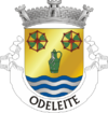
Coat of arms
Country Portugal
Municipality Castro Marim
Area
 - Total 141.78 km2 (54.7 sq mi)
Population (2001)
 - Total 934
 - Density 6.6/km2 (17.1/sq mi)
Coordinates 37°20′N 7°29′W / 37.333°N 7.483°W / 37.333; -7.483Coordinates: 37°20′N 7°29′W / 37.333°N 7.483°W / 37.333; -7.483

Odeleite is a freguesia (parish) in the municipality of Castro Marim (Algarve, Portugal).


Wikimedia Foundation. 2010.

Игры ⚽ Нужно сделать НИР?

Look at other dictionaries:

  • Castro Marim — Wappen Karte …   Deutsch Wikipedia

  • Castro Marim — Saltar a navegación, búsqueda Para la freguesía, véase Castro Marim (freguesía). Castro Marim …   Wikipedia Español

  • Castro Marim — Géolocalisation sur la carte : Portugal …   Wikipédia en Français

  • Castro Marim — Infobox Municipality pt official name = Castro Marim image coat of arms = CTM.png Region = Algarve Subregion = Algarve District = Faro Mayor name = José Estevens Mayor party = PSD area total = 300.9 population total = 6,495 population density =… …   Wikipedia

  • Odeleite — Freguesia de Portugal …   Wikipedia Español

  • Voie rapide portugaise IC27 — Voie Rapide Castro Marim Beja  IC 27  Longueur 32 km (92 km) De Castro Marim ( A22 ) Intersectio …   Wikipédia en Français

  • Каштру-Марин — Муниципалитет Каштру Марин порт. Castro Marim Флаг Герб …   Википедия

  • Административное деление округа Фару — …   Википедия

  • Guadiana — Para otros usos de este término, véase Guadiana (desambiguación). Río Guadiana El Guadiana,a su paso por un puente viejo del tren. País que atraviesa …   Wikipedia Español

  • Районы округа Фару —   Это служебный список статей, созданный для координации работ по развитию темы.   Данное предупреждение не ус …   Википедия

Share the article and excerpts

Direct link
Do a right-click on the link above
and select “Copy Link”