- Novo-kamenniy Bridge
-
Novo-kamenniy Bridge
Новокаменный мост
Looking upstream[clarification needed]Official name Old Yamskoi Vodoprovodniy Aqueduct[citation needed] Carries Vehicles, trams and pedestrians Crosses Obvodny Canal Locale Saint Petersburg, Russian Federation Designer Gerard (1800s); Bazaine (1816–1821); Erakov (1846–1848); Guttsajt (1967–1970) Design Beam (Gerard, Guttsajt); arch (Bazaine, Erakov) Material Wood (Gerard); granite (Bazaine); brick and stone (Erakov); reinforced concrete (Guttsajt) Total length 25,6 m (Bazaine); 42,7 m (Erakov); 38,2 m (Guttsajt) Width 14 m (Erakov); 44,8 m (Guttsajt) Opened 1821 (Bazaine); 1848 (Bazaine); 1970 (Guttsajt) Coordinates 59°54′54″N 30°21′02″E / 59.915°N 30.35056°ECoordinates: 59°54′54″N 30°21′02″E / 59.915°N 30.35056°E Water system of Ligovsky Canal Legend


Dudergofskoye lake 


Dudergofka River 
1718-1721  To Moskovskoye s.
Three highways interchange 
Ring Road  To Bronka
Three highways interchange 
Dachnaya street Three highways interchange 
Diameter  To sea port terminal


 To Predportovaya


 To Ulyanka, Ligovo
 To Predportovaya


 To Leninsky Prospekt
 To Predportovaya


 To Leninsky Prospekt
 To Konstitutsii square


Leninsky Pr.  To Leninsky Metro


Krasnenkaya River  To Konstitutsii square


Krasnoputilovskaya  To Avtovo
Moscow Gate Square 


Moskovsky Prospekt Tsarskoselskaya Railway 


Kubinskaya Street Obvodny Y. V. Aqueduct 


Aviatorov Pound Znamenskya Square 


Nevsky Prospekt Pounds 


Fontanka River 


Panteleymonovsky Aqueduct 
Fountains of Summer garden Pounds in Tauride garden 


Steam pump 

Water inlet 1720s Neva River 


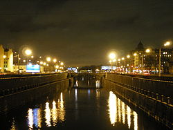
Moyka River Novo-kamenniy Bridge is a crossing of the Obvodny Canal in Saint Petersburg, Russian Federation. The bridge forms part of Ligovsky Avenue and connects Bezimyanni Island with the Tsentralny and Frunzensky districts of the city.
Contents
History
‘Gerard’ bridge
The first bridge to be built was constructed at the end of the 18th century; construction was supervised by engineer Ivan Gerard. The ‘Gerard’ bridge replaced a wooden beam aqueduct built to carry the Ligovsky Canal—the Yamskoi Vodoprovodniy Aqueduct—though the Ligovsky Canal was filled-in in the 1890s;[citation needed] the ‘Gerard’ bridge occupied the alignment of the filled-in canal.[citation needed]
‘Bazaine’ bridge
After having problems with decay[clarification needed] and levels of passenger traffic, the ‘Gerard’ bridge was replaced. Engineer Pierre-Dominique Bazaine supervised the construction of the second bridge on the current bridge's site, which took place between 1816 and 1821.[citation needed]
‘Erakov’ bridge
A third bridge was constructed between 1846 and 1848 under the direction of engineer A. N. Erakov. The ‘Erakov’ bridge featured granite pools for drinking from,[clarification needed by rewording sentence] with the water being sourced from the Ligovsky Canal.[citation needed] The ‘Erakov’ bridge was repaired and reconstructed in 1862, 1872 and 1874[citation needed]—though changes were not made to the bridge's design or general appearance.
Current (‘Guttsajt’) bridge
With intensive building in southern areas of (the then) Leningrad in the 1950s, Ligovsky Avenue and the roads around Obvodny Canal Quay became congested.[citation needed] The 14 metre-wide ‘Erakov’ bridge—built in 1848—was too narrow to cope with the volume of traffic using it and, thus, a decision was taken[who?] to substantially widen the bridge.
The current bridge was designed by architect L. A. Noskov[citation needed] and was constructed between 1968 and 1970, developed by engineers N. P. Agapov and A. D. Guttsajt.[citation needed] The ‘Guttsajt’ bridge was substantially wider than its predecessor—at just under 45 metres in width—and was opened to public use on November 7 1970.[citation needed]
Gallery
References
Pierre-Dominique Bazaine (1786 - 1838) Construction Demidov Bridge | First Engineer Bridge | Obvodny Canal | Novo-kamenniy bridge · project in 1814, constructed in 1816 - 1821 
Merit The director of Institute of means of communication · Lieutenant General Tunnels in Saint Petersburg on a year of opening All tunnels of this city are in List of tunnels in Saint PetersburgTunnels under water Orlovskiy tunnel · 2011 • Kanonersky tunnel · 1983
Tunnels of entrances on the bridge Liteyny Bridge · Peter the Great Bridge · Alexander Nevsky Bridge · Novo-kamenniy bridge · Novo-moskovskiy bridgeTunnels of considerable outcomes Tunnel under Pobedy Square · Toksovskoye Shosse tunnelGreatest foot tunnels Categories:- Pierre-Domonique Bazaine
- Tunnels in Russia
- Aqueducts in Russia
- Bridges completed in 1821
- Bridges completed in 1848
- Bridges completed in 1862
- Bridges completed in 1872
- Bridges completed in 1874
- Bridges completed in 1895
- Bridges completed in 1970
- Bridges in Saint Petersburg
Wikimedia Foundation. 2010.


