- Nosy Alañaña Light
-
Nosy Alañaña Light 
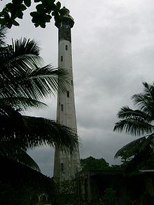
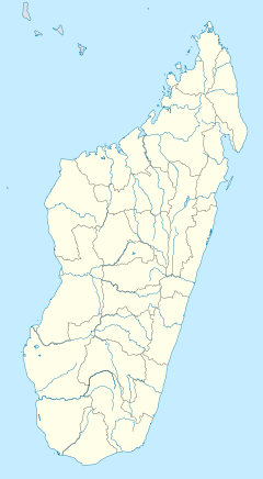
Nosy Alañaña Light, 2006 Location Toamasina, Madagascar Coordinates 18°2′55.45″S 49°27′36.15″E / 18.0487361°S 49.4600417°ECoordinates: 18°2′55.45″S 49°27′36.15″E / 18.0487361°S 49.4600417°E Year first constructed 1932 Construction concrete Tower shape octagonal, gallery, lantern Markings / pattern white, blacl lantern and gallery Height 197 feet (60 m) Focal height 197 feet (60 m) Range 23 nautical miles (43 km; 26 mi) Characteristic three white flashes, separated by 5s, every 25s Admiralty number D6972 NGA number 112-32460 ARLHS number MAG-009 Nosy Alañaña Light, also known as Île aux Prunes Light (French: Phare de l'Île aux Prunes), is an active lighthouse in Île aux Prunes, Toamasina Province, Madagascar. At a height of 197 feet (60 m) it is the twenty-fourth tallest "traditional lighthouse" in the world,[1] as well as the tallest in Africa. It is located on Île aux Prunes (Isle of Prunes, Malagasy: Nosy Alañaña), a tiny island about 16 kilometres (9.9 mi) north-northeast of Toamasina.
The island is accessible by boat, and the site is open, but the tower is closed to the public.
See also
- List of tallest lighthouses in the world
References
- ^ Rowlett, Russ. "The Tallest Lighthouses". The Lighthouse Directory. University of North Carolina at Chapel Hill. http://www.unc.edu/~rowlett/lighthouse/tallest.htm.
- (PDF) List of Lights, Pub. 112, Western Pacific and Indian Oceans Including the Persian Gulf and Red Sea. List of Lights. United States National Geospatial-Intelligence Agency. 2009. p. 525. http://msi.nga.mil/MSISiteContent/StaticFiles/NAV_PUBS/NIMA_LOL/Pub112/Pub112bk.pdf.
- Rowlett, Russ. "Lighthouses of Madagascar". The Lighthouse Directory. University of North Carolina at Chapel Hill. http://www.unc.edu/~rowlett/lighthouse/mdg.htm.
Categories:- Lighthouses in Madagascar
- 1932 architecture
- Toamasina Province
- Madagascar geography stubs
- Lighthouse stubs
Wikimedia Foundation. 2010.

