- Northampton Parish, New Brunswick
-
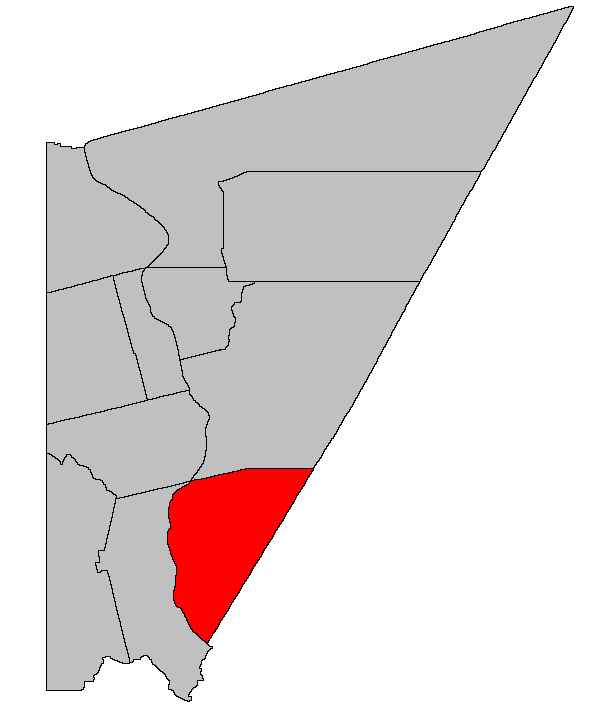
Northampton — Parish — Location of Northampton Parish within Carleton County, New Brunswick
Coordinates: 46°05′N 67°33′W / 46.08°N 67.55°W Country  Canada
Province  New Brunswick
County Carleton Established 1830 Area[1] – Land 243.31 km2 (93.9 sq mi) Population (2006)[1][2] – Total 1,599 – Density 6.6/km2 (17.1/sq mi) – Change 2001-06  6.4%
6.4%– Census Ranking 1,537 of 5,008 Time zone AST (UTC-4) – Summer (DST) ADT (UTC-3) Dwellings 706 Median Income* $42,323 CDN *Median household income, 2005 (all households) Northampton is a Canadian parish in Carleton County, New Brunswick.[3]
Its population in the 2006 Census was 1,599.
Contents
Delineation
Northampton Parish is defined in the Territorial Division Act as:
- Southeast by the County line; west by the Saint John River, and north by a line commencing at a marked cedar post about fifty-three rods northward of the mouth of Shaws Creek on the bank of the Saint John River, at Jesse Shaw’s upper side line; thence by the Magnet of 1928 and by Deputy A.E. Hanson’s survey of the same year, south 57 degrees east along the aforesaid side line 31.70 chains to a marked cedar post, being about 3 feet south 57 degrees east from a large cup shaped rock, thence south 82 degrees east and parallel to the present lower line of lot No. 12 originally granted to Thomas Shaw, and maintaining a rectangular distance of 8.96 chains south of said lower line of Lot No. 12, one hundred and fifty-three chains (153 chs.) or to the southwest corner of Lot No. 3 (2nd Tier) granted originally to Michael McKinney in the survey of 2nd Tier of Lots East of the Saint John River by Deputy Andrew Blair in the year 1830, thence from said southwest corner and continuing along the original division line of lots No. 3 and No. 4 granted respectively to Michael McKinney and Martin Hale, or to the rear line of these said lots thence continuing south eighty-three degrees east or to where it strikes or intersects the west or south side line of Block C granted to the York and Carleton Mining Company having a total estimated distance of 191 chains thence by the magnet of the year 1848 south 73 degrees East, and estimated distance of four hundred and ten chains more or less, or to the County line.
Communities
Demographics
Population
Population trend[4]
Census Population Change (%) 2006 1,599 6.4%2001 1,708  16.7%
16.7%1996 1,464 10.1%1991 1,330 N/A Language
Mother tongue language (2006)[1]
Language Population Pct (%) English only 1,535 96.54% Other languages 25 1.57% French only 20 1.26% Both English and French 10 0.63% See also
References
- ^ a b c 2006 Statistics Canada Community Profile: Northampton Parish, New Brunswick
- ^ Statistics Canada Population and dwelling counts, for Canada and census subdivisions (municipalities), 2006 and 2001 censuses - 100% data
- ^ New Brunswick Provincial Archives - Northampton Parish
- ^ Statistics Canada: 1996, 2001, 2006 census

Wakefield Parish Brighton Parish Woodstock Parish 
Southampton Parish (York County)  Northampton Parish

Canterbury Parish (York County) Subdivisions of New Brunswick Subdivisions Cities Counties Albert · Carleton · Charlotte · Gloucester · Kent · Kings · Madawaska · Northumberland · Queens · Restigouche · Saint John · Sunbury · Victoria · Westmorland · YorkCategories:- Parishes of New Brunswick
- Carleton County, New Brunswick
Wikimedia Foundation. 2010.