- North Toe River
-
North Toe River River 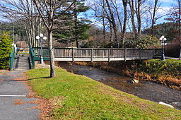 Bridge over the North Toe River in Newland
Country United States State North Carolina Counties Avery, Mitchell, Yancey Tributaries - left Kentucky Creek, Cow Camp Creek, Haw Branch, Row Branch, Squirrel Creek, Plumtree Creek, Pancake Branch, Clear Creek, Threemile Creek, Brushy Creek, Laurel Creek, Harris Creek, White Oak Branch, Rose Creek, Cathis Creek, Grassy Creek, English Creek, Big Branch, Wolf Branch, South Toe River, Chestnut Branch, Brush Creek, Pigpen Creek, Jacks Creek, Bee Branch, McKinney Branch, Cane River - right Hickorynut Branch, Whiteoak Creek, Banjo Branch,Fall Branch, Horse Branch, Gooseneck Branch, Birchfield Creek, Race Path Branch, Whitaker Branch, Roaring Creek, Powdermill Creek, Doublehead Creek, Henson Creek, Justice Creek, Puatt Creek, Jones Creek, Little Laurel Branch, Bill Davenport Branch, Jake Creek, Beaver Creek, Pine Branch, Little Bear Creek, Lily Branch, Gouge Branch, Sink Hole Creek, Rose Creek, Cane Creek, Whitson Branch, Big Rock Creek, Raccoon Creek, Warrick Branch, Brummett Creek, Pigeonroost Creek, Cooper Branch Source - location Avery County, NC - elevation 4,280 ft (1,305 m) - coordinates 36°07′47″N 81°53′13″W / 36.12972°N 81.88694°W Mouth Nolichucky River - location Yancey County, NC - elevation 2,021 ft (616 m) - coordinates 36°01′44″N 82°19′37″W / 36.02889°N 82.32694°W The North Toe River[1] is a large stream in the North Carolina High Country. The headwaters begin between Bald Mountain and Sugar Mountain, what is known as Sugar Gap, in Avery County. The river proceeds to go southwest till it ends with a confluence with the Cane River, forming the Nolichucky River in Yancey County.
Hydrography
See also
- List of North Carolina rivers
References
Categories:- Rivers of North Carolina
- Geography of Avery County, North Carolina
- Geography of Mitchell County, North Carolina
- Geography of Yancey County, North Carolina

Wikimedia Foundation. 2010.