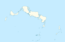
North Caicos Airport

North Caicos Airport
IATA: NCAICAO: MBNC
Summary
Airport type Public
Location North Caicos, Turks and Caicos Islands
Elevation AMSL 10 ft / 3 m
Coordinates 21°55′03″N 071°56′22″W / 21.9175°N 71.93944°W / 21.9175; -71.93944Coordinates: 21°55′03″N 071°56′22″W / 21.9175°N 71.93944°W / 21.9175; -71.93944
Map
MBNC is located in Turks and Caicos Islands
MBNC
Location in North Caicos
Runways
Direction Length Surface
m ft
08/26 1,294 4,245 Asphalt
Source: DAFIF[1][2]

North Caicos Airport (IATA: NCAICAO: MBNC) is an airport serving North Caicos,[1] the second largest of the Turks and Caicos Islands.

Contents

Facilities

The airport resides at an elevation of 10 ft (3 m) above mean sea level. It has one runway designated 08/26 with an asphalt surface measuring 1,294 × 23 m (4,245 × 75 ft).[1]

Airlines and destinations

As of January 2010, only one airline offers scheduled services to and from North Caicos Airport:

Airlines Destinations
Air Turks and Caicos Providenciales

References

  1. ^ a b c Airport information for MBNC at World Aero Data. Data current as of October 2006.
  2. ^ Airport information for NCA at Great Circle Mapper. Source: DAFIF (effective Oct. 2006).

External links


Wikimedia Foundation. 2010.

Игры ⚽ Нужен реферат?

Look at other dictionaries:

  • Middle Caicos Airport — IATA: MDS – ICAO: MBMC Summary Airport type Public Serves Middle Caicos, Turks and Caicos Islands El …   Wikipedia

  • North American call sign — Many countries have specific conventions for classifying call signs by transmitter characteristics and location. The North American call sign format for radio and television call signs follows a number of conventions. All call signs begin with a… …   Wikipedia

  • Providenciales International Airport — IATA: PLS – ICAO: MBPV Summary …   Wikipedia

  • JAGS McCartney International Airport — Infobox Airport name = JAGS McCartney International Airport nativename = nativename a = nativename r = image width = caption = IATA = GDT ICAO = MBGT type = Public owner = operator = Civil Aviation Department city served = location = Grand Turk… …   Wikipedia

  • Air Turks and Caicos — Infobox Airline airline = Air Turks and Caicos logo size = 250 px fleet size = 5 destinations = 9 IATA = JY ICAO = IWY callsign = ISLANDWAYS parent = Interisland Aviation Services company slogan = founded = 1990 s headquarters = key people = hubs …   Wikipedia

  • Global Airways (Turks and Caicos) — Global Airways is an Air Charter airline based at the Providenciales International Airport which is the main airport of the Turks and Caicos Islands. Destinations Global Airways serves the following destinations:*Grand Turk *Middle Caicos *North… …   Wikipedia

  • Transportation in North America — North America contains a varied transportation system, whose quality ranges from being on par with a high quality European motorway to an unpaved gravelled back road that can extend hundreds of miles. There is also an extensive transcontinental… …   Wikipedia

  • Turks and Caicos Islands — Turks and Caicos Islands …   Wikipedia

  • Cibao International Airport — Aeropuerto Internacional del Cibao American Airlines Airbus A300 taxiing. IATA: STI – ICAO: MDST – …   Wikipedia

  • Dallas-Fort Worth International Airport — Infobox Airport name = Dallas Fort Worth International Airport IATA = DFW ICAO = KDFW FAA = DFW type = Public owner = City of DallasCity of Fort Worth operator = DFW Airport Board city served = Dallas / Fort Worth elevation f = 607 elevation m =… …   Wikipedia

Share the article and excerpts

Direct link
Do a right-click on the link above
and select “Copy Link”