- Nizhnekolymsky District
-
Coordinates: 71°25′N 136°10′E / 71.417°N 136.167°E
 Coat of arms
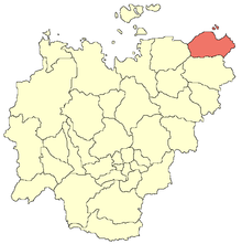 Location in the Sakha Republic
Nizhnekolymsky District (Russian: Нижнеколымский улус; Sakha: Аллараа Халыма улууһа) is a district (ulus) of the Sakha Republic, Russia. It is municipally incorporated as the Municipal District of "Nizhnekolymsky Ulus" (муниципальный район "Нижнеколымский улус").[1] The administrative center of the district is the settlement of Chersky.[1] District population: 5,932 (2002 Census);[2]
Municipally, Nizhnekolymsky Ulus is divided into one urban settlement (with the administrative center in Chersky), which has one rural locality in its jurisdiction, and three rural settlements (formed on the basis of three administrative naslegs), comprising eleven rural localities.[3]
References
- ^ a b Law of the Sakha (Yakutia) Republic 172-Z #351-III of November 30, 2004 On Establishing the Borders of and Granting the Status of a Municipal District to the Municipal Formations of the Sakha (Yakutia) Republic, with consequent amendments.
- ^ Федеральная служба государственной статистики (Federal State Statistics Service) (2004-05-21). "Численность населения России, субъектов Российской Федерации в составе федеральных округов, районов, городских поселений, сельских населённых пунктов – районных центров и сельских населённых пунктов с населением 3 тысячи и более человек (Population of Russia, its federal districts, federal subjects, districts, urban localities, rural localities—administrative centers, and rural localities with population of over 3,000)" (in Russian). Всероссийская перепись населения 2002 года (All-Russia Population Census of 2002). Federal State Statistics Service. http://www.perepis2002.ru/ct/doc/1_TOM_01_04.xls. Retrieved 2010-03-23.
- ^ Law of the Sakha (Yakutia) Republic 173-Z #353-III of November 30, 2004 On Establishing the Borders and Conferring the Status of Urban and Rural Settlements to the Municipal Formations of the Sakha (Yakutia) Republic; with subsequent amendments.
See also
External links
Categories:- Districts of the Sakha Republic
- East Siberian Sea

Wikimedia Foundation. 2010.