- Ngora
-
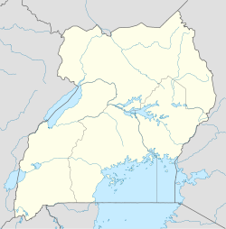
Ngora Location in Uganda Coordinates: 01°27′20″N 33°46′41″E / 1.45556°N 33.77806°E Country  Uganda
Region Eastern Uganda Sub-region Teso sub-region District Ngora District Government – Mayor Elevation 3,609 ft (1,100 m) Population (2004 Estimate) – Total 9,200 Ngora is a town in Eastern Uganda. It is the main political, administrative and commercial centre of Ngora District. The district is named after the town.
Contents
Location
Ngora is located approximately 42 kilometres (26 mi), by road, southeast of Soroti, the largest city in the sub-region.[1] This location lies approximately 230 kilometres (140 mi), by road, northeast of Kampala, the capital of Uganda and the largest city in that country.[2] The coordinates of the town are:01 27 20N, 33 46 41E (Latitude:1.4555; Longitude:33.7780).[3]
Population
As of December 2010[update], the exact population of Ngora is not known. However, in 2004, the population of the town was estimated at about 9,200 people.[4]
Landmarks
The landmarks within the town limits or close to the edges of the town include:
- The headquarters of Ngora District Administration
- The offices of Ngora Town Council
- Ngora Central Market
See also
- Ngora District
- Teso sub-region
- Teso people
- Eastern Region, Uganda
References
- ^ "Map Showing Soroti And Ngora With Distance Marker". Distancecalculator.globefeed.com. http://distancecalculator.globefeed.com/Uganda_Distance_Result.asp?fromplace=Ngora%20(Pallisa)&toplace=Soroti%20(Soroti)&fromlat=1.4313889&tolat=1.6855556&fromlng=33.7772222&tolng=33.6163889. Retrieved 2011-09-28.
- ^ "Road Distance Between Kampala And Ngora With Map". Distancecalculator.globefeed.com. http://distancecalculator.globefeed.com/Uganda_Distance_Result.asp?fromplace=Ngora%20(Pallisa)&toplace=Kampala%20()&fromlat=1.4313889&tolat=0.3155556&fromlng=33.7772222&tolng=32.5655556. Retrieved 2011-09-28.
- ^ Ngora Mukura Rd (1970-01-01). "Location of Ngora At Google Maps". Maps.google.com. http://maps.google.com/maps?f=q&source=s_q&hl=en&geocode=&q=1.4555,+33.7780&sll=1.456497,33.776436&sspn=0.008108,0.021973&ie=UTF8&ll=1.4521,33.778238&spn=0.015874,0.043602&t=h&z=15. Retrieved 2011-09-28.
- ^ "Estimated Population of Ngora In 2004". Wolframalpha.com. 2011-09-08. http://www.wolframalpha.com/entities/cities/ngora,_uganda/9p/pr/sl/. Retrieved 2011-09-28.
Capital: NgoraTowns and villages NgoraCategories:- Populated places in Uganda
- Cities in the Great Rift Valley
- Ngora District
- Eastern Region, Uganda
Wikimedia Foundation. 2010.

