- Nevelskoy Strait
-
Coordinates: 52°10′13″N 141°36′19″E / 52.17028°N 141.60528°E
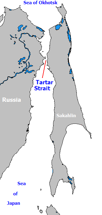
 The Strait of Tartary connects the Sea of Okhostsk to the Sea of Japan.
 A satellite image of the Nevelskoy Strait
The Nevelskoy Strait (Russian: Пролив Невельского) is a strait between Eurasia and Sakhalin that connects the main body of the Strait of Tartary with the Amur Liman (Amur River estuary). It was named in memory of Capt. Gennady Nevelskoy who in 1849 difinitively established that the Strait of Tartary is connected with the Amur estuary and thus is in fact a strait, and not a gulf.
Length: 56 km, width (narrowest): 7.3 km, fairway depth: 7.2 m.
The strait was a place for the contemplated Sakhalin Tunnel.
Categories:- Russia geography stubs
- Straits of the Pacific Ocean
- Straits of Asia
- Straits of Russia
- Sakhalin

Wikimedia Foundation. 2010.