- Nemnyuga River
-
Coordinates: 65°28′05″N 43°41′40″E / 65.46806°N 43.69444°E
Nemnyuga
Russian: НемнюгаMouth Kuloy Basin countries Russia Length 201 km (125 mi)[1] Mouth elevation 4 Avg. discharge 26 cubic metres per second (920 cu ft/s)[1] Basin area 3,630 square kilometres (1,400 sq mi)[1] 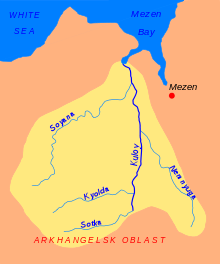 The Kuloy River basin. The Nemnyuga is shown
The Nemnyuga (Russian: Немнюга) is a river in Leshukonsky, Pinezhsky, and Mezensky Districts of Arkhangelsk Oblast in Russia. It is a right tributary of the Kuloy River. It is 201 kilometres (125 mi) long, and the area of its basin 3,630 square kilometres (1,400 sq mi). The principal tributaries are the Korda River (left), the Parsova River (left), and the Shala River (right).
The river basin of the Nemnyuga comprises a vast area between the Kuloy and the Mezen rivers which belongs to three districts of Arkhangelsk Oblast, Leshukonsky, Pinezhsky, and Mezensky Districts.
The source of the Nemnyuga is located in Leshukonsky District, very close to the border with Pinezhsky District. The river flows west, crosses into Pinezhsky District, and turns north. At the confluence with its right tributary, the Berezov, the Nemnyuga turns north-west and starts meandering.
The only settlements on the river are Sovpolye and Chizhgora, both at the confluence of the Sova, a right tributary of the Nemnyuga. Downstream from Chizhgora, there is a ferry crossing on the road connecting Arkhangelsk and Mezen.
The lower course of the Nemnyuga, the 37 kilometres (23 mi) stretch downstream from the selo of Sovpolye, is navigable, although there is no passenger navigation.
References
- ^ a b c Немнюга. Great Soviet Encyclopedia. http://bse.sci-lib.com/article081062.html.
External links
- "Река Немнюга" (in Russian). State Water Register of Russia. http://textual.ru/gvr/index.php?card=163386. Retrieved 5 August 2011.
Categories:- Rivers of Arkhangelsk Oblast
- Kuloy River basin

Wikimedia Foundation. 2010.