- Narmedeshwor
-
Narmedeshwor — Village development committee — Location in Nepal
 Narmedeshwor
Coordinates: 27°22′N 86°14′E / 27.36°N 86.24°ECoordinates: 27°22′N 86°14′E / 27.36°N 86.24°E Country  Nepal
NepalZone Sagarmatha Zone District Okhaldhunga District Population (1991) – Total 1,610 Time zone Nepal Time (UTC+5:45) Narmedeshwor is a village development committee in Okhaldhunga District in the Sagarmatha Zone of mid-eastern Nepal. At the time of the 1991 Nepal census it had a population of 1610 living in 285 individual households.[1]
References
- ^ "Nepal Census 2001", Nepal's Village Development Committees (Digital Himalaya), http://www.digitalhimalaya.com/collections/nepalcensus/form.php?selection=1, retrieved 15 November 2009.
External links
Andhari, Baksa, Balakhu, Baraneshwor, Barnalu, Betini, Bhadaure, Bhussinga, Bigutar, Bilandu, Chyanam, Diyale, Fediguth, Fulbari, Gamnangtar, Harkapur, Jantarkhani, Jyamire, Kalikadevi, Kaptigaun, Katunje, Ketuke, Khiji Chandeshwori, Khijifalate, Kuibhir, Kuntadevi, Madhavpur, Mamkha, Manebhanjyang, Moli, Mulkharka, Narmedeshwor, Palapu, Patle, Pokhare, Pokli, Prapchan, Ragani, Rajadeep, Raniban, Ratmata, Rawadolu, Rumjatar, Salleri, Serna, Shreechaur, Singhadevi, Sisneri, Taluwa, Tarkerabari, Thakle, Thoksela, Thulachhap, Ubu, Vadaure, Yasam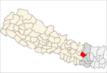 Categories:
- Populated places in Okhaldhunga District
- Sagarmatha Zone geography stubs


Wikimedia Foundation. 2010.