- Hoeselt
Infobox Belgium Municipality
name=Hoeselt
picture=
picture-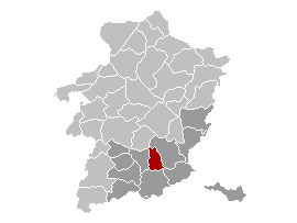
map-
arms=Hoeselt wapen.jpg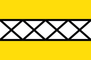
region=BE-REG-FLE
community=BE-NL
province=BE-PROV-LI
arrondissement=Tongeren
nis=73032
pyramid-date=
0-19=
20-64=
65=
foreigners=
foreigners-date=
mayor=Annette Stulens (Nieuw)
majority=Nieuw, VLD-Vivant, CD&V
postal-codes=3730
telephone-area=089
web= [http://www.hoeselt.be/ www.hoeselt.be]
lat_deg=50
lat_min=51
lon_deg=05
lon_min=29Hoeselt is a
municipality located in the Belgian province of Limburg. OnJanuary 1 2006 Hoeselt had a total population of 9,265. The total area is 30.02 km² which gives apopulation density of 309 inhabitants per km².While situated close to the "Roman" Tongeren, a lot of traces from the Roman empire were found in the furtile soil of Hoeselt. In 1066 this village came under the surveillance of Hoei, it was in that time still named Housle (Hus+Lo: house by the forest). These forests of Hoeselt were cultivated in the 12th and 13th century.
Later on, Hoeselt was part of the Frankish Kingdom; and then its territory fell under the
Bishop of Liège .The old centre of Hoeselt, with its triangular shape, and the "motheuvel", both show the influence of its Frankish past.
External links
* [http://www.hoeselt.be Official website ] - Available only in Dutch


Wikimedia Foundation. 2010.