- Nansena Island (Franz Josef Land)
-
For other uses, see Nansen Island (disambiguation).
Coordinates: 80°18′N 54°06′E / 80.3°N 54.1°E
Nansena Island Russian: остров Нансена 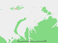
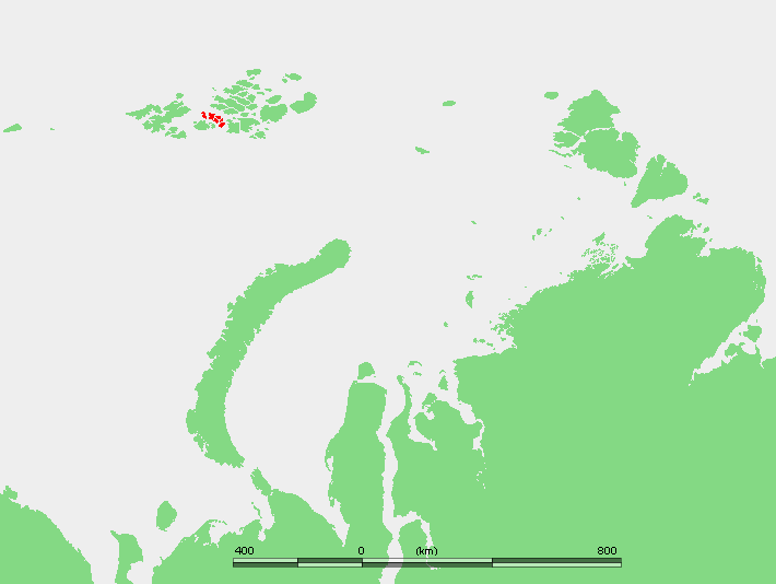
Location of the group formed by Nansen Island and its adjacent islands in the Franz Josef Archipelago.Geography Coordinates 80°18′00″N 54°06′00″E / 80.300°N 54.100°E Archipelago Franz Josef Archipelago Area 164 km2 (63.3 sq mi) Highest elevation 372 m (1,220 ft) Country Demographics Population 0 Nansena Island (Russian: о́стров На́нсена; Ostrov Nansena) is an island in Franz Josef Land, Russia. The island is partly glaciated and its area is 164 km2 (63 sq mi). The highest point of the island is 372 m (1,220 ft).
The island is located in the center of a cluster of islands of similar size separated from each other by narrow sounds. The channel to the southwest of the subgroup is Proliv Allen-Yung (пролив Аллен-Юнг), the one at the southeast is Proliv Sidorova (пролив Сидорова), the channel to the northeast is the Proliv Markama (пролив Маркама), and the one in the west is the Proliv Britansky Kanal (пролив Британский Канал).
Mys Artura is the cape in the north of the island. The cape in the southwest is known as Mys Ushakova, after Russian Arctic explorer Georgy Ushakov, and the southernmost point is called Mys Teylora (Cape Taylor).
Nansena Island is named in the honor and memory of Arctic explorer Fridtjof Nansen, who explored and charted the Franz Josef Archipelago in 1896.
Contents
Adjacent islands
- Ostrov Ketlitsa (Остров Кетлица), Koetlitz Island is a long island which lies off the northwestern tip of Nansen island. Glacierized, maximum height
158 m (518 ft). The cape at its northern end is known as Mys Polyarnogo Siyaniya and its southernmost came is Mys Giuys. The channel separating this island from Nansen island is known as Proliv Roberta Piliya. Koetlitz Island was named in honor of the geologist of the 1894-1897 Jackson-Harmsworth Arctic Expedition to the Franz Josef Archipelago, Dr. Reginald Koetlitz. - Ostrov Uiltona (Остров Уильтона), Wilton Island is a small island off Nansen Island's northeastern coast. It is separated from it by a 1 km (0.62 mi) narrow sound. It was named after Scottish explorer David W. Wilton, also of the 1894-1897 Jackson-Harmsworth Arctic Expedition. Wilton had lived for some years in the north of Russia before joining the expedition.
- Ostrov Bromidzh (Остров Бромидж), Bromwich Island lies east of Nansen Island; (lat 80.49 long 54.9). It is covered by an ice-cap, but it has a few unglacierized areas at small points near its shores. Maximum height 392 m (1,286 ft).
- Ostrov Braysa (Остров Брайса), Brice Island lies south of Bromwich Island. There is an icecap in the middle of the island but large swathes of land are unglacierized in the north and southwest. Maximum height 409 m (1,342 ft). This island was named after Arthur Montefiore Brice, the secretary of the 1894-1897 Jackson-Harmsworth Arctic Expedition.
- Ostrov Pritchetta (Остров Притчетта), Pritchett Island lies off Nansen Island's southern shore. This island is quite large and has a few areas free of glaciers. Highest point 401 m (1,316 ft). The name of this island is very likely a corruption of Karl Weyprecht's name (the initial syllable "We" having disappeared). Since Weyprecht was one of the two leaders of the Austro-Hungarian North Pole Expedition, along with Payer, who has an island named after him further to the northeast in the same archipelago, it is very unlikely that Weyprecht would not have an island named after him in Franz Josef Land.
- Ostrov Blissa (Остров Блисса), Bliss Island lies south of Pritchet Island. Partly unglacierized.
- Ostrov Dzheffersona (Остров Джефферсона), Jefferson Island is a much smaller island lying off Nansen Island's southwestern shore. This island was named in honor of Thomas Jefferson by the 1901 Baldwin-Ziegler North Pole Expedition.
See also
References
External links
- [1] & [2]
- Recent expeditions: [3]
- On the (sometimes bewildering) spelling of Russian geographical names: [4]
- David W. Wilton: [5]
Categories:- Islands of Franz Josef Land
- Uninhabited islands of Russia
- Ostrov Ketlitsa (Остров Кетлица), Koetlitz Island is a long island which lies off the northwestern tip of Nansen island. Glacierized, maximum height
Wikimedia Foundation. 2010.