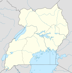
- Namutumba, Uganda
-
Namutumba Location in Uganda Coordinates: 00°50′06″N 33°41′06″E / 0.835°N 33.685°E Country  Uganda
Region Eastern Uganda Sub-region Busoga sub-region District Namutumba District Government – Mayor Elevation 3,543 ft (1,080 m) Population (2011 Estimate) – Total 10,600 Namutumba is a town in Eastern Uganda. It is the main municipal, administrative and commercial centre of Namutumba District. The district is named after the town.
Contents
Location
Namutumba is located approximately 88 kilometres (55 mi), by road, northeast of Jinja, the largest city in the sub-region.[1] This location is approximately 43 kilometres (27 mi), by road, northeast of Iganga, the closest large town.[2] The town of Busembatya, about 13.5 kilometres (8.4 mi)[3], to the southwest of Namutumba, is the closest neighboring trading center and has the nearest Post Office. However, Busembatya is located in Iganga District. To the northeast of Namutumba is Tirinyi, another small town on the main Iganga-Mbale Road. It is part of Pallisa District and has the nearest bank. The coordinates of Namutumba are:00 50 06N, 33 41 06E (Latitude:0.8350; Longitude:33.6850).
Overview
The town of Namutumba is situated on the major highway between Iganga and Mbale, on the Tirinyi Bridge Road which is locally known as the Tirinyi - Mbale Road. Namutumba is a sister city to the town of Ross-on-Wye, in Herefordshire, England, United Kingdom.There is a public library at Nsinze subcounty headquarter set up by Mpolyabigere RC RICED Center. www.mpolya.org, a local charity that also conducts HIV/AIDS counselling and testing outreaches to distant villages.
Population
The 2002 national census estimated the population of Namutumba at approximately 8,300. In 2010, the Uganda Bureau of Statistics (UBOS) estimated the town's population at about 10,300.[4] In 2011, UBOS estmated the population of Namutumba at about 10,600.[5]
Landmarks
The landmarks within the town limits or close to the edges of the town include:
- The headquarters of Namutumba District Administration
- The offices of Namutumba Town Council
- Kisiki College
- Namutumba Central Market
- The Iganga-Mbale Road - The road, which goes through the middle of town, cuts town the travel time between the two towns by at least two (2) hours.
Schools
There are many secondary schools in Namutumba District, some of which are listed below
- Kisiki College
- Kangulumo Secondary School
- Agape Secondary School
- Central Secondary School
- Namutumba Mixed School
- Magada Secondary School
- Ivukula Secondary School
- Bugobi High School
- Kibale High School
- Kyabazinga Secondary School
- Nabinyonyi Parents School
- Kigalama Secondary School
- Bukonte Seed School
- Kaswabuli Secondary School
Kibale High School is pioneering the teaching and UNEB examination of Lusoga at 'O' levels in Uganda.
External links
See also
- Namutumba District
- Busoga
- Busoga sub-region
- Basoga
References
 Namutumba DistrictCapital: Namutumba
Towns and villages NamutumbaEducation Kisiki CollegeCategories:- Namutumba District
- Populated places in Uganda
- Cities in the Great Rift Valley
- Eastern Region, Uganda
- Busoga
Wikimedia Foundation. 2010.

