- Nafusa Mountains
-
Nafusa Mountains الجبل الغربي, جبال نفوسة Location in Libya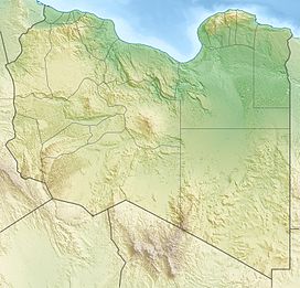
 Nafusa Mountains
Elevation 968 m (3,176 ft) [1] Location Location Tripolitania, northwest Libya Coordinates 31°51′54″N 11°47′36″E / 31.8649°N 11.7933°ECoordinates: 31°51′54″N 11°47′36″E / 31.8649°N 11.7933°E The Nafusa Mountains (Berber: Adrar n Infusen (Nafusa Mountain), Arabic: الجبل الغربي Al Ǧabal al Gharbi (Western mountain)) are a mountain range in the western Tripolitania region of northwestern Libya. It also includes their regions around the escarpment formed where the northern end of the Tripolitanian Plateau meets the Mediterranean coastal plain or the Jefara.
Contents
History
- Berber people
The area has been significant since before recorded history as a major population and cultural center of the Berber people. It still shelters most of Libya's Berber-speaking population - and the Nafusi language. In addition to their living society and culture, the area contains a rich variety of Berber material inheritance, which goes back over millenia.
- Libyan civil war
This distinct culture, suppressed and oppressed by the Libyan regime, has risen to new prominence in the course of the 2011 Libyan civil war, when their initiatives led to the Nafusa Mountains becoming a major front in that war.[2][3] The terrain and topography of the region are critical strategic factors, constraining mechanised advances from the flat plain and plateau, and favouring guerrilla tactics based on close local knowledge and the advantage of high ground. By the end of June 2011 the Nafusi people had almost succeeded in liberating themselves completely from the control of the regime, and this progress seems likely to continue.[2]
Geography
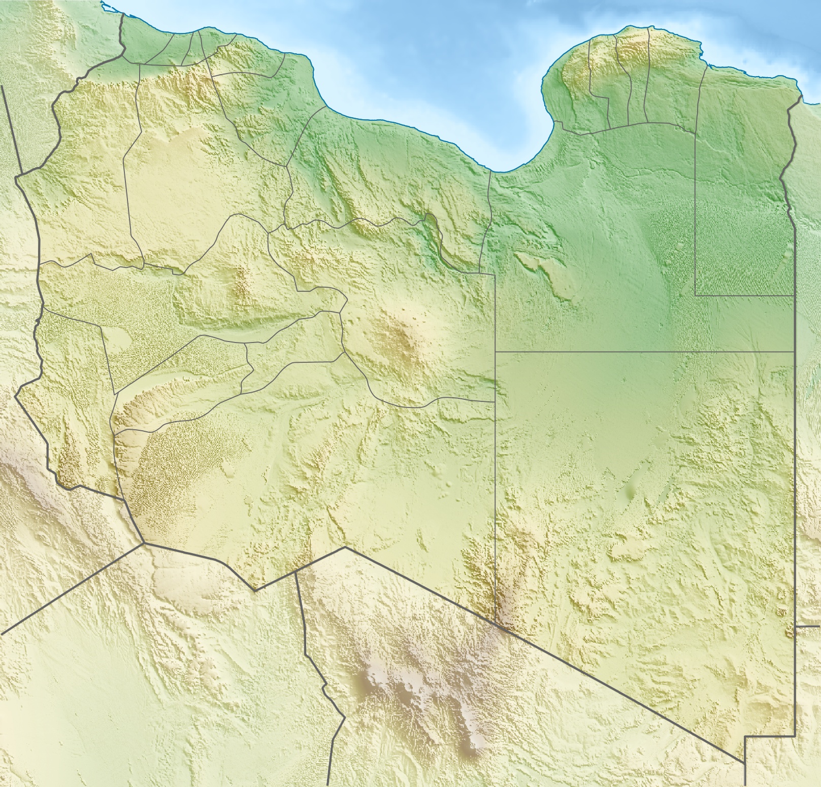
See also: Geography of LibyaThe Nafusa Mountains form the boundary between the Libyan coastal plain, known as the Jafara, to the north, and the Tripolitanian Plateau to the south. The beds (strata) of the Tripolitanian Plateau slope downwards to the south and tilt upwards towards the north creating the highest portion of the plateau as the Nafusa mountains which rise to over 750 meters.[4][5][6] The plateau ends abruptly on the north with an escarpment which has up to 350 meters of topographic prominence. A series of deep valleys which drain north toward the Jefara cut into this escarpment.[6] It extends some 250 kilometers within Libya, from just east of the city of Gharyan (about 60 kilometers south of Tripoli) in the east to the city of Wazzin at the Tunisian border in the west. Spurs and isolated upthrusts continue into Tunisia, but this region is almost unpopulated, in marked contrast to the situation in Libya.
The mountain area is rarely more than 25 kilometers in depth, from its southern boundary, the flat arid plateau some 650 meters above sea level, to its northern limit on the plain, where the land falls to below 150 meters. Much of the 500 meter drop in level is accomplished abruptly, at the escarpment, where local topographic prominences may be up to 350 meters. It is from below, on the plain, viewing the steep slopes and sharply-etched skyline that the area appears mountainous; from the plateau the land appears merely hilly, and in fact it is rather flat apart from the effects of differential erosion.
Towns in the mountains include Gharyan, Yafran, Zintan, Jadu, Kabaw, Al-Qawalish and Nalut, which have all been the sites of military action during the 2011 civil war. Since 2007, the mountains stretch across two districts: Jabal al Gharbi District and Nalut District.
Economy
The mountain villages raise primarily goats, olives and grain, but also have fig and apricot orchards.[7]
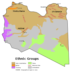 Ethic composition of the Libyan population in 1974. The orange arc in the Northwest shows the Berber population in the Nafusa Mountains.
2011 Libyan civil war
Main article: 2011 Nafusa Mountains CampaignThe Nafusa Mountains became first a hotbed for anti-Gaddafi protests (with protests breaking out relatively early in Nalut and Zintan) and then a rebel stronghold, an island of rebel control in the mainly Gaddafi-controlled western part of the country. During the early stages, forces allied to the national transitional government succeeded in evacuating most non-combatants into Tunisia; the Wazzin border crossing has been captured and held to ensure supply lines from Tunisia; all the mountain towns have been retaken; the front has been extended to the plains, cutting regime communications lines and allowing electricity to be restored. They have become the first rebel combatants to be supplied with arms by air-drop.[8]
In the course of the civil war, many towns in the area were subjected to shelling by artillery and rockets from both sides, with much damage to infrastructure. Regime forces cut off electricity and water supplies. Médecins Sans Frontières sent a team in Zintan to help the large number of wounded.[9] As of 21 May, there were reports that Al Galaa was without electricity and water for seven weeks and more than 45,000 refugees went to the Tunisian region of Tatouine.[10][11]
Cultural renaissance
As towns and villages in the Nafusa Mountains and surrounding areas were liberated from control by forces loyal to Muammar Gaddafi in early summer 2011, and while fierce fighting continued, Berber exhibitions and workshops sprang up to share and spread the Tamazight culture and language, after four decades during which there were severe punishments for speaking and writing Tamazight openly.[12]
References
- ^ Willeitner, Joachim (2001). Tripolitanien, Syrtebogen, Fezzan und die Kyrenaika. DuMont Reiserverlag. p. 14. ISBN 3770148762.
- ^ a b Laub, Karin (15 August 2011). "Libya's western mountain rebels taste success". CNS News. Associated Press. http://cnsnews.com/news/article/libyas-western-mountain-rebels-taste-suc. Retrieved 18 August 2011.
- ^ Map of situation on 28 June 2011 at [1]
- ^ Asketell, J. M. and Ghellali, S. M. (1991) "A palaeogeologic map of the pre-Tertiary surface in the region of the Jifarah Plain: its implication to the structural history of Northern Libya" in Salime, M. J. et al. (ed.) (1991) The geology of Libya. Volume IV-VII : Third Symposium on the Geology of Libya, held at Tripoli, September 27-30, 1987 Elsivier, Amsterdam, volume VI, pp. 2381-2406, ISBN 0-444-88844-6
- ^ El-Zouki, Ashour V. (1980) "Stratigraphy and lithofacies of the continental clastic (Upper Jurassic and Lower Cretaceous) of Jabal Nafusah, NW Libya" in Salem, M. J. and Busrewil, M. T. (ed.) (1980) The Geology of Libya: Symposium on the Geology of Libya (2nd : 1978 : Tripoli, Libya) Academic Press, New York, volume II, pp. 394-418, ISBN 0-12-615501-1
- ^ a b Megerisi, Mohamed and Mamgain, V. D. (1980) "The Upper Cretaceous-Tertiary formations of northern Libya" in Salem, M. J. and Busrewil, M. T. (ed.) (1980) The Geology of Libya: Symposium on the Geology of Libya (2nd : 1978 : Tripoli, Libya) Academic Press, New York, volume I, pp. 67-72, ISBN 0-12-615501-1
- ^ Faul, Michelle (23 May 2011). "High-level US diplomat meets Libyan rebel leaders". CNS News. Associated Press. http://www.cnsnews.com/news/article/high-level-us-diplomat-meets-libyan-rebe. Retrieved 18 August 2011.
- ^ Spencer, Richard (29 June 2011). "France supplying weapons to Libyan rebels". The Telegraph. http://www.telegraph.co.uk/news/worldnews/africaandindianocean/libya/8606541/France-supplying-weapons-to-Libyan-rebels.html. Retrieved 18 August 2011.
- ^ "MSF expands operations in response to growing needs in Libya". Médecins Sans Frontières. 18 May 2011. http://www.msf.org/msf/articles/2011/05/msf-expands-operations-in-response-to-growing-needs-in-libya.cfm. Retrieved 18 August 2011.
- ^ Robertson, Nic (22 May 2011). "Libyan begs NATO to save his small town". CNN International Edition. Cable News Network. http://edition.cnn.com/2011/WORLD/africa/05/21/libya.small.towns/. Retrieved 18 August 2011.
- ^ "More than 45,000 Libyan refugees in Tataouine". Tunisian News Agency. 21 May 2011. http://www.tap.info.tn/en/en/regions/2575-more-than-45000-libyan-refugees-in-tataouine.html. Retrieved 18 August 2011.
- ^ Simpson, John (5 July 2011). "Waiting game for rebels in western Libya". BBC News. http://www.bbc.co.uk/news/world-africa-14026216. Retrieved 18 August 2011.
External links
 Mountains of LibyaAcacus • Bikku Bitti • Sherif • Haruj • Arkanu • Jebel Akhdar • Nafusa • Tibesti • Al Uweinat • Waw an NamusCategories:
- Mountains of Libya
- Tripolitania
- Geography of Libya

![[1]](http://www.libyafeb17.com/wp-content/uploads/2011/06/nafusa-map-june-28.png)
Wikimedia Foundation. 2010.