- Myponga Wind Farm
-
Myponga Wind Farm Location of Myponga Wind Farm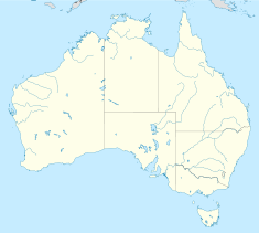

Country Australia Location South of Adelaide Coordinates 35°24′0″S 138°27′18″E / 35.4°S 138.455°ECoordinates: 35°24′0″S 138°27′18″E / 35.4°S 138.455°E Commission date 2010 Owner(s) TrustPower Power station information Primary fuel Wind Generation units 16 Power generation information Maximum capacity 48 MW The Myponga Wind Farm is a wind farm project proposed by TrustPower in the southern Mount Lofty Ranges, on the Fleurieu Peninsula 50 km south of Adelaide, South Australia. Development approval was granted in 2003,[1] and the project was planned to be operational by the end of 2010.[2]
In 2009, TrustPower announced that it would not proceed with the project, because the South Australian government had not approved variations to height, layout and turbine type in the existing planning approval.[3] The requested change was to reduce the number of turbines to 16 but increase their power output and increase the height of the turbines from 100 metres to 110 metres.[4]
Contents
Location
The site is 400m above sea level, between the towns of Myponga and Sellicks Beach.
See also
References
- ^ White, Rod (20 November 2003). "Support for Myponga wind farm". The Times. http://www.victorharbortimes.com.au/news/local/news/general/support-for-myponga-wind-farm/227114.aspx.
- ^ Nankervis, David (23 August 2009). "Wind farm for Adelaide fringe". Sunday Mail. http://www.news.com.au/adelaidenow/story/0,27574,25966853-2682,00.html.
- ^ "TPW: TrustPower decides not to proceed with Myponga Wind Farm" (Press release). Trustpower. 10 September 2009. http://www.findata.co.nz/Markets/NZX/21825/TrustPower_decides_not_to_proceed_with_Myponga_Wind_Farm.htm. Retrieved 2010-10-16.
- ^ Holloway, Paul (8 September 2009). "Myponga/Sellicks Hill Wind Farm". Government of South Australia. http://www.ministers.sa.gov.au/news.php?id=5327. Retrieved 2009-09-10.
External links
Categories:- Wind farms in South Australia
- Proposed wind farms in Australia
- Wind farm stubs

Wikimedia Foundation. 2010.