Murgap District — District Country Turkmenistan Province … Wikipedia
Turkmenistan — /terrk me neuh stan , stahn /, n. a republic in central in Asia, bordering the Caspian Sea, Iran, and Afghanistan. 4,225,351; 188,417 sq. mi. (488,000 sq. km). Cap.: Ashkhabad. Also called Turkomen. Formerly, Turkmen Soviet Socialist Republic. *… … Universalium
Early history of Turkmenistan — This article documents the early history of Turkmenistan.Like the other Central Asian republics, Turkmenistan underwent the intrusion and rule of several foreign powers before falling under first Russian and then Soviet control in the modern era … Wikipedia
History of Turkmenistan — While the ancient history of early Turkmenistan is largely shrouded in mystery, its past since the arrival of Indo European Iranian tribes around 2000 BC is often the starting point of the area s discernible history. Early tribes were nomadic or… … Wikipedia
Geography of Turkmenistan — Dust Storm Over Turkmenistan Turkmenistan is a landlocked country in Central Asia, bordering the Caspian Sea to the west, Iran and Afghanistan to the south, Uzbekistan to the north east, and Kazakhstan to the north west. It is the southernmost… … Wikipedia
Districts of Turkmenistan — Okresi of Turkmenistan Turkmenistan … Wikipedia
List of cities, towns and villages in Turkmenistan — An A Z list of settlements in Turkmenistan. For a list of the main cities and towns see List of cities in Turkmenistan *Adzhi *Adzhikui *Adzhiyab *Agar *Ahal *Ak *Ak Altyn *Ak Bay *Akbogaz *Ak Bulak *Akdash *Ak Dashayak *Akdepe *Ak Gaudan… … Wikipedia
Villes du Turkménistan — Carte du Turkménistan Aşgabat … Wikipédia en Français
Liste der Städte in Turkmenistan — Dies ist eine Liste der Städte in Turkmenistan. In der Tabelle sind die Städte über 8.000 Einwohner, die Ergebnisse der Volkszählung (Zensus) vom 12. Januar 1989, eine Berechnung für den 1. Januar 2010 sowie die übergeordnete Verwaltungseinheit… … Deutsch Wikipedia
Murghab River — Murghāb (Persian: مرغاب, meaning Birds River), or Morghāb, also transliterated from Tajiki Мурғоб and Russian Мургаб as Murghob and Murgab, is the name of two distinct rivers in Central Asia: Murghab River (Afghanistan), the river that rises in… … Wikipedia
 Location in Turkmenistan
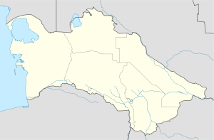
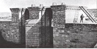
 Murgap
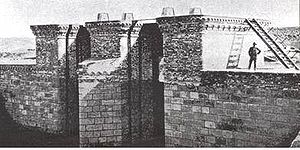
 Turkmenistan