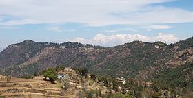
- Mukteshwar Temple
-
Mukteshwar Temple 
Name Other names: मुक्तेश्वर मंदिर Proper name: Mukteshraan da Mandir Location Country: India State: Punjab Location: ShapurKandi Dam Road Architecture and culture Architectural styles: Built by The Pandavas during their Agayatwas History Date built:
(Current structure)At the time of Mahabharata Mukteshwar temple (मुक्तेश्वर मंदिर) is one of the most sacred places around Pathankot Punjab. These caves are on the way to Shahpur Kandi and This temple is dedicated to Lord Shiva and is situated on the bank of the River Ravi, about 20–22 km from Pathankot City in Shaupur Kandi. The temple is also known as the Mukesran Mandir A mela, called the Mukesran Da Mela, is held every year, in the month of April, to mark Baisakhi. Lots of pilgrim from all over the Punjab and nearby state Himachal and Jammu and kashmir comes here for puja every year (worship) mainly on that mela and on Shiv Ratri
History
These caves which date to the time of the Mahabharata according to a legend, the Pandavas stayed in those caves for a while during their "Agayatwas" (exile) and is believed to have served as the house of the Pandavas, during their exile. Situated at the hilltop, Mukteshwar temple has a white marble Shivling, with a copper Yoni. The Shivling is surrounded by the idols of Lord Brahma, Lord Vishnu, Goddess Paravati, Lord Hanuman and Lord Ganesha..
Transport
This temple is very well connected by road to nearby state Jammu and kashmir, Himachal and is just 21 km away from Pathankot, one can easily reach here by road. The Ranjit Sagar Dam Hydroelectric Project is just 2 km from here. The left bank of river falls in the Punjab State and the Right Bank in J&K State, so the view of the river Ravi and hills is awesome.
Categories:- Shiva temples
- Hindu temples in Punjab (India)
Wikimedia Foundation. 2010.
