- Mount William (Antarctica)
-
Mount William 
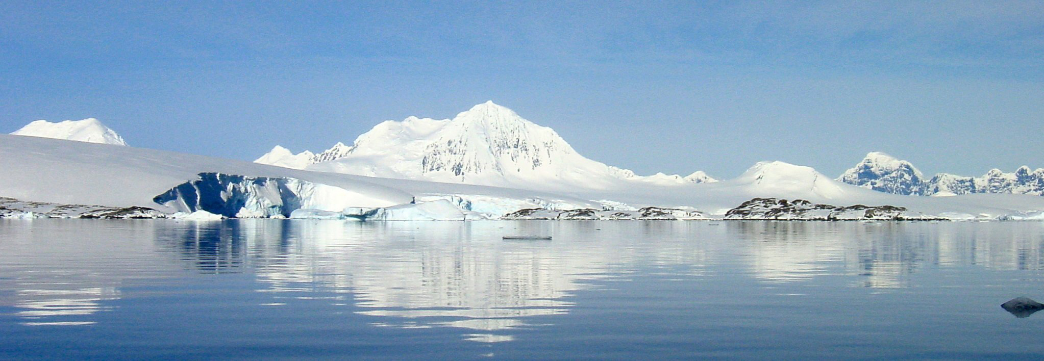
Mount William behind the Marr Ice Piedmont Glacier, November 2002Elevation 1,600 m (5,249 ft) [1] Location Location Anvers Island, Antarctica Coordinates 64°47′S 63°41′W / 64.783°S 63.683°WCoordinates: 64°47′S 63°41′W / 64.783°S 63.683°W[1] Mount William is a prominent snow-covered mountain, 1,600 m, standing 4 miles (6 km) north-northeast of Cape Lancaster, the south extremity of Anvers Island, in the Palmer Archipelago. It was discovered on February 21, 1832, by John Biscoe who believed it to be part of the mainland of Antarctic Peninsula. Named by Biscoe for William IV, then King of the United Kingdom.[1]
Reference

This Palmer Archipelago location article is a stub. You can help Wikipedia by expanding it.