- Mount McArthur (British Columbia)
-
For other uses, see Mount McArthur.
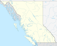
Mount McArthur British Columbia, Canada Elevation 3,021 m (9,911 ft) [1] Prominence 221 m (725 ft) [1] Listing Mountains of British Columbia Location Range Park Ranges Coordinates 51°32′26″N 116°35′48″W / 51.54056°N 116.59667°WCoordinates: 51°32′26″N 116°35′48″W / 51.54056°N 116.59667°W[1] Topo map NTS 82N/10 Climbing First ascent 1891 by W.S. Drewry, Dominion Topographic Survey[1] Mount McArthur is a mountain located in Yoho National Park, British Columbia, Canada. It was named in 1886 by Otto Koltz after James J. McArthur, a land surveyor who mapped the Canadian Rockies for the Canadian Pacific Railway.[1]
References
- ^ a b c d e "Mount Alfred". Bivouac.com. http://www.bivouac.com/MtnPg.asp?MtnId=1665. Retrieved 2010-12-04.
Categories:- Mountains of British Columbia
- Yoho National Park
Wikimedia Foundation. 2010.

