- Mount Hikurangi (Gisborne)
-
For the mountain in Northland, New Zealand, see Mount Hikurangi, Northland.
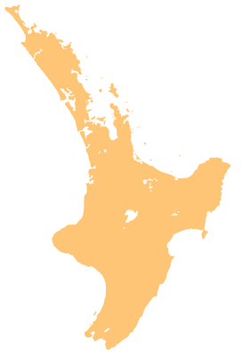
Mount Hikurangi Location of Mount Hikurangi in New Zealand Elevation 1,754 m (5,755 ft) Prominence Listing List of mountains of New Zealand by height Location Location North Island,  New Zealand
Range Raukumara Range Coordinates 37°55′01.07″S 178°03′36.08″E / 37.9169639°S 178.0600222°ECoordinates: 37°55′01.07″S 178°03′36.08″E / 37.9169639°S 178.0600222°E Mount Hikurangi (or Te Ara ki Hikurangi in Māori) is a 1754 metre (5755 feet) peak in the northeastern corner of New Zealand's North Island, 60 kilometres (37 mi) southwest of East Cape. It is the North Island's highest non-volcanic peak.
The peak is sacred to the Ngati Porou Māori of the region, who regard it as the resting place of Nukutaimemeha, the waka (canoe) of the legendary hero Maui.
Contents
The first sunrise of the new day
The peak is traditionally regarded as the first land in the world to catch the rays of the new day's sun, although this claim, like any such claim of its type, is open to interpretation. Certainly it is not true at any time of the year other than the southern hemisphere summer, as both Fiji and Tonga are to the east. In summer, however, because of the tilt of the Earth's axis, it does receive the sun's rays earlier than these places. It does not receive them earlier than the Chatham Islands (or, of course, Antarctica), however, and in mid-summer, some of the hills of the southeastern South Island receive the sun fractionally earlier. This did not stop the mountain gaining world prominence in the celebrations for the new Millennium, however.
See also
References
- Mount Hikurangi - Te Ara ki Hikurangi NZ Department of Conservation
External links
Categories:- Mountains of New Zealand
- Gisborne Region
- Māori mythology
- Gisborne Region geography stubs
- Māori stubs
Wikimedia Foundation. 2010.

