- Mount Emu Creek
-
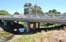
Mount Emu Creek is a long but small meandering waterway located in the west of Victoria. The total length of the Mount Emu Creek is over 250 kilometres. The creek forms near Trawalla, and Trawalla Creek flows to Mount Emu Creek , the quantity and quality of water from Trawalla Creek is of great importance to Mount Emu Creek. Trawalla Creek drains the area of highest rainfall within Mount Emu Creek’s catchment. It appears that Trawalla Creek contributes most the of the good quality water that enters Mount Emu Creek. Mount Emu Creek has a length of approximately 70 kilometres through this sub-catchment, and passes through the township of Darlington. Mount Emu Creek is the major waterway within the Hopkins Basin. The main drainage area is from numerous small tributaries and gullies to the east and west of the waterway, including Darlington Creek.[1]
The waterway starts as a series of creeks and waterways which merge together to form the Mount Emu Creek which flows through areas around Beaufort, Skipton, Darlington, Terang and Panmure. It joins the Hopkins River which eventually leads out to sea at Warrnambool. The Mount Emu system is a very popular fishing stream with the locals and out-of-towners where trophy sized trout can be pursued. The creek is regularly stocked with brown trout from the department of Natural Resources and environment (with the assistance of the Terang Angling Club.) There is also a small population of wild brown trout. Trophy size trout are there to be taken but most fish average around the 1 kilo mark. Some of the more popular spots to be fished are McKinnons bridge, Castlecary Road bridge, Ayresford Road and Panmure bridge. Other fish to be caught include redfin, eels, tench, tupong and black fish.[2]
Platypuses
Mount Emu Creek abounds in redfin and is the home of many platypuses. A recent trapping survey has confirmed that platypus are breeding successfully right in the heart of Skipton township. The all night research session along the Mount Emu Creek was conducted by the Australian Platypus Conservancy, in collaboration with Skipton's Stewart Park Committee. A baby female was one of six platypuses found in the 5 kilometre section of the creek. Weighing in at just 680 grams, the tiny juvenile had probably only first ventured out of her burrow a week or so previously. Geoff Williams, biologist with the Conservancy, said that the youngster was in really good condition and her presence confirmed that successful breeding is taking place in the township. [3]
Murdering Gully Massacre
Murdering Gully massacre occurred in a gully on Mount Emu Creek, where a small stream adjoins from Merida station (near Camperdown) in early 1839. Between 35 and 40 men, women and children of the Tarnbeere gundidj clan, were shot by Frederick Taylor and other shepherds for the killing of several sheep. [4],
References
Categories:- Rivers of Victoria (Australia)

Wikimedia Foundation. 2010.