- Motorways in the Republic of Macedonia
-
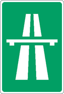
 The road sign informing the motorists they are travelling on an avtopat
The motorways in the Republic of Macedonia are called avtopat (Macedonian: автопат) and the name, like its translation in most languages, simply means auto road.
The current system has inherited much from the former Yugoslavia. Pay-tolls (patarini) remain in place and the speed limit is still 120 km/h (75 mph).
The highways were originally marked with yellow-colour hard shoulder lines and some of these remain in place, they are however slowly being phased out and replaced with white. The motorway roadsigns maintain their green colour background, a feature shared with Switzerland, Italy, Denmark, Sweden, Greece, Lithuania and the United States as well as the other former Yugoslav republics. The roads are on the whole straight with good surfacing, and better maintained than the national roads.
Contents
Motorway M1
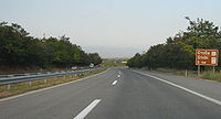
 M-1 near Stobi
The first motorway runs from the Tabanovce border crossing with Serbia (for Preševo), passing Kumanovo (M2 junction), Petrovec (Skopje Airport) near Skopje (M3 junction), Veles, Gradsko (M5 junction) Negotino (M7 junction), and continuing onto the main border crossing with Greece, Bogorodica-Evzoni near Gevgelija.
The large part of this express route was built whilst Macedonia was a part of the SFR Yugoslavia, with the Kumanovo-Petrovec section first opened for traffic in 1979. The motorway was fully completed in 2004 in time for the Athens Olympics.
For approximately 30 km between Skopje Airport and Veles, the motorway splits, creating a gradual distance of several kilometres. The northbound route is the postulated motorway route whilst the slightly longer southbound route, with dangerous bends, is the old road currently being used as a freeway as it is only one-way. There are no plans at present to develop the northbound route into two separate carriageways thus perfecting the network.
Motorway M2
The M2 is a planned motorway that will connect Kumanovo (M1) with Kriva Palanka and the Deve Bair border crossing with Bulgaria.
Motorway M3
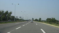
 M-3 entering Skopje
The M3 is the connection of Skopje to Kosovo, part of European route E65.
Motorway M4
This motorway was mostly constructed since independence. It can be joined near Skopje from the other express route. This route sends its drivers through urban Skopje and westbound towards Tetovo where it then turns southwards and ends close to Gostivar.
This is a very scenic route as it passes the Shar mountain range, with beautiful mountain villages, and the peak of Mount Korab is also visible.
M4 will continue towards Kičevo and end near Struga and Ohrid.
Motorway M5
The M5 will traverse the country from east to west, between the border with Bulgaria near Delčevo, via Kočani, Štip, Veles (M1 junction), Prilep, Bitola, ending in Ohrid (M4 junction).
Motorway M6
The M6 will connect Štip (M5 junction) via Radoviš and Strumica to the border with Bulgaria near Novo Selo.
Motorway M7
The M7 is planned to span the country from west to east, going through Debar, Kičevo (M4 junction), Makedonski Brod, Prilep (M5 junction), Kavadarci, Negotino (M1 junction), Radoviš (M6 junction).
Categories:- Road transport in the Republic of Macedonia
- Roads in the Republic of Macedonia
Wikimedia Foundation. 2010.
