- Morvich, Highland
-
Coordinates: 57°13′54″N 5°23′00″W / 57.2316°N 5.38322°W
Morvich Scottish Gaelic: A’ Mhormhaich 
 Morvich
Morvich shown within the Highland council areaOS grid reference NG958207 Council area Highland Country Scotland Sovereign state United Kingdom Post town Kyle Postcode district IV40 8 Police Northern Fire Highlands and Islands Ambulance Scottish EU Parliament Scotland List of places: UK • Scotland • Morvich (Gaelic:A’ Mhormhaich[1]) is a very small settlement near the southern end of Loch Duich, and to the north of Kintail, in Lochalsh, in the Highland council area of Scotland. The name "Morvich" may be from the Gaelic for "sea plain" or "the carse"[1].
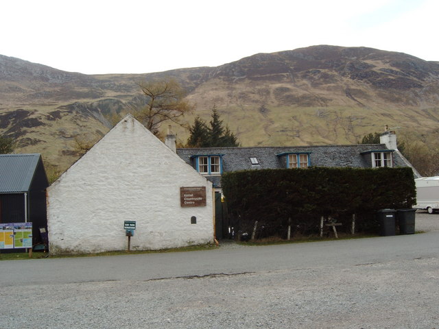
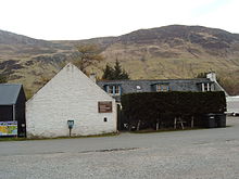 NTS Countryside Centre
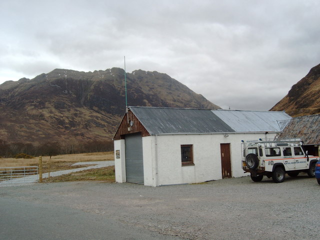
This place is within the estate of Kintail & Morvich, owned by the National Trust for Scotland, they operate a countryside centre and an outdoor centre in Morvich[2]. Morvich is also the location of the base for Kintail Mountain Rescue Team[3], as well a campsite operated by The Caravan Club[4].
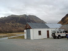 Kintail Mountain Rescue Station
The A87 road passes by Morvich, the village of Inverinate is located about 3 km west along the Loch Duich, while Shiel Bridge is about 2 km to the south west.
Morvich is a popular starting point for hiking. Routes include the mountains of the Five Sisters of Kintail and Beinn Fhada, as well as to the Falls of Glomach, one of the highest waterfalls in Scotland[5]. A longer route is to hike from Morvich through to Glen Affric, via Gleann Chòinneachan or Gleann Lichd. The lattter route is used by the Highland Cross, an annual duathlon from Morvich to Beauly, 50 miles away on the east coast.
 Remains of St Dubhthach's Church
The ruins of St Dubhthach's Church are to the west of Morvich, next to the A87. This church was dedicated to Saint Duthac in 1050. Next to the church is the Clachan Duich, the traditional burial ground of Clan Macrae.
References
- ^ a b "Place name database - Morvich". Ainmean-Àite na h-Alba. http://www.ainmean-aite.org/database.asp?intent=details&id=378. Retrieved 2011-02-20.
- ^ "Property Details for Kintail & Morvich". National Trust for Scotland. http://www.nts.org.uk/Property/40/. Retrieved 20 February 2011.
- ^ "The Team Base at Morvich". Kintail Mountain Rescue Team. http://www.kintailmrt.org.uk/base.htm. Retrieved 20 February 2011.
- ^ "Link Details - Morvich Caravan Club Site". ScottishCamping. http://www.scottishcampingguide.com/link.php?n=22&c=. Retrieved 20 February 2011.
- ^ "Morvich to the Falls of Glomach". VisitScotland. http://walking.visitscotland.com/walks/westhighlands/214112. Retrieved 20 February 2011.
Categories:- Populated places in Lochalsh
- Highland geography stubs


Wikimedia Foundation. 2010.