- Montmajor
-
Montmajor — Municipality — 
Flag
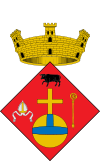
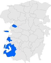
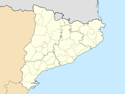
Coat of armsMap showing location within Berguedà Location in Catalonia Coordinates: 42°013′09″N 1°44′09″E / 42.21917°N 1.73583°ECoordinates: 42°013′09″N 1°44′09″E / 42.21917°N 1.73583°E Country  Spain
SpainCommunity  Catalonia
Province Barcelona Comarca Berguedà Government - Mayor Josep Maria Corominas i Reig Area - Total 76.49 km2 (29.5 sq mi) Elevation 756 m (2,480 ft) Population (2008) - Total 472 - Density 6.2/km2 (16/sq mi) Demonym Montmajorenc, montmajorenca Time zone CET (UTC+1) - Summer (DST) CEST (UTC+2) Website Town Website Montmajor is a municipality in the comarca of Berguedà, Catalonia.
Geography
Montmajor is made up of four distinct enclaves, quite separated from one another. The principal area of the town essentially surrounds the town of Navès, which is in the comarca of Solsonès. The northernmost enclave is Catllarí (5.45 km²), which is surrounded by the municipalities of Fígols, Castellar del Riu, and Guixers. Comesposades (8.01 km²), is separated from the main town by L'Espunyola. Valielles (3.20 km²), meanwhile, is an enclave completely surrounded by Solsonès.
References
External links
- Town Website
- Information from the Generalitat de Catalunya
- Information from the Institut d'Estadística de Catalunya
Municipalities of Berguedà Avià · Bagà · Berga · Borredà · Capolat · Casserres · Castell de l'Areny · Castellar de n'Hug · Castellar del Riu · Cercs · L'Espunyola · Fígols · Gironella · Gisclareny · Guardiola de Berguedà · Gósol · Montclar · Montmajor · La Nou de Berguedà · Olvan · La Pobla de Lillet · Puig-reig · La Quar · Sagàs · Saldes · Sant Jaume de Frontanyà · Sant Julià de Cerdanyola · Santa Maria de Merlès · Vallcebre · Vilada · Viver i Serrateix Categories:
- Municipalities in Barcelona
- Berguedà
- Populated places in Barcelona
Wikimedia Foundation. 2010.


