- Monte Plata
-
This article is about the municipality. For the province, see Monte Plata Province.
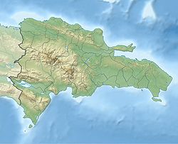
Monte Plata — Municipality — Coordinates: 18°48′36″N 69°47′24″W / 18.81°N 69.79°WCoordinates: 18°48′36″N 69°47′24″W / 18.81°N 69.79°W Country  Dominican Republic
Province Monte Plata Founded 1606 Area[1] – Total 623.55 km2 (240.8 sq mi) Elevation[2] 56 m (184 ft) Population (2002)[3] – Total 37,614 – Density 60.3/km2 (156.2/sq mi) – Urban 14,850 – Rural 22,764 Municipal Districts 3 Distance to
– Santo Domingo
153 kmMonte Plata is a municipality (municipio) and the capital of the Monte Plata province in the Dominican Republic. It includes the municipal districts (distritos municipal) of Boyá, Chirino, and Don Juan.[4]
As of the Dominican Republic's 2002 census, the municipality had a total population of 37,614 inhabitants, of which 14,850 resided in urban areas and 22,764 in rural areas.[3]
Contents
History
Monte Plata was founded with the towns of Monte Cristi and Puerto Plata, which were destroyed by disposition of the king of Spain of the epoch and executed by Antonio Ozorio Governor of the Island, both towns gave name, they united Monte of Monte Cristi and calling it Plata Puerto Plata Monte Plata, were 87 neighbors that is to say heads of families the ones that founded to Monte Plata.
Hydrology
In the municipality the main rivers of the province are the Ozama and the Yabacao. Other rivers are tributary, Yamasá, Mijo, Sabita and Guanuma.
Culture
The main cultural wealth that have are its elements folk, dances, songs, stories, oral traditions and written, historic monuments, their popular religiousness, beliefs. These the mountainous foothills they form it, their rivers and gaps, which constitute a great wealth the tourism.
References
- ^ Superficies a nivel de municipios, Oficina Nacional de Estadistica
- ^ De la Fuente, Santiago (1976) (in Spanish). Geografía Dominicana. Santo Domingo, Dominican Republic: Editora Colegial Quisqueyana.
- ^ a b "VIII Censo 2002 Poplación y Vivienda" (in Spanish) (PDF in ZIP). Oficina Nacional de Estadística. 9 February 2004. http://one.gob.do/censo/volumen_I_pdf.zip. Retrieved 12 August 2011.
- ^ "Listado de Codigos de Provincias, Municipio y Distritos Municipales, Actualizada a Junio 20 del 2006" (in Spanish). Oficina Nacional de Estadistica, Departamento de Cartografia, Division de Limites y Linderos. 20 June 2006. Archived from the original on 14 March 2007. http://web.archive.org/web/20070314215735/http://www.one.gob.do/index.php?option=com_docman&task=cat_view&gid=113. Retrieved 12 August 2011.
Municipalities Bayaguana • Monte Plata • Peralvillo (Esperalvillo) • Sabana Grande de Boyá • Yamasá
Municipal districts Monte Plata: Boyá • Chirino • Don Juan – Sabana Grande de Boyá: Gonzalo • Majagual – Yamasá: Los Botados
Provincial capitals of the Dominican Republic Azua · Baní · Barahona · Bonao · Comendador · Cotuí · Dajabón · El Seibo · Hato Mayor · Higüey · Jimaní · La Romana · La Vega · Mao · Moca · Monte Cristi · Monte Plata · Nagua · Neiba · Pedernales · Puerto Plata · Sabaneta · Salcedo · Samaná · San Cristóbal · San Francisco de Macorís · San José de Ocoa · San Juan de la Maguana · San Pedro de Macorís · Santiago de los Caballeros · Santo Domingo · Santo Domingo Este

Wikimedia Foundation. 2010.

