- Monsenhor Tabosa
-
Monsenhor Tabosa — Municipality and town — Country  Brazil
Region Nordeste State Ceará Mesoregion Sertoes Cearenses Time zone UTC -3 Monsenhor Tabosa is a town and municipality in the state of Ceará in the Northeast region of Brazil.[1][2][3][4]
See also
References
- ^ "Divisão Territorial do Brasil" (in Portuguese). Divisão Territorial do Brasil e Limites Territoriais, Instituto Brasileiro de Geografia e Estatística (IBGE). July 1, 2008. ftp://geoftp.ibge.gov.br/Organizacao/Divisao_Territorial/2008/DTB_2008.zip. Retrieved December 17, 2009.
- ^ "Estimativas da população para 1º de julho de 2009" (in Portuguese) (PDF). Estimativas de População, Instituto Brasileiro de Geografia e Estatística (IBGE). August 14, 2009. http://www.ibge.gov.br/home/estatistica/populacao/estimativa2009/POP2009_DOU.pdf. Retrieved December 17, 2009.
- ^ "Ranking decrescente do IDH-M dos municípios do Brasil" (in Portuguese). Atlas do Desenvolvimento Humano, Programa das Nações Unidas para o Desenvolvimento (PNUD). 2000. http://www.pnud.org.br/atlas/ranking/IDH-M%2091%2000%20Ranking%20decrescente%20(pelos%20dados%20de%202000).htm. Retrieved December 17, 2009.
- ^ "Produto Interno Bruto dos Municípios 2002-2005" (in Portuguese). Instituto Brasileiro de Geografia e Estatística (IBGE). December 19, 2007. http://www.ibge.gov.br/home/estatistica/economia/pibmunicipios/2005/tab01.pdf. Retrieved December 17, 2009.
 Municipalities of CearáCapital: Fortaleza
Centro-Sul Cearense IguatuLavras da MangabeiraBaixio · Ipaumirim · Lavras da Mangabeira · UmariVarzea AlegreAntonina do Norte · Cariús · Jucás · Tarrafas · Várzea Alegre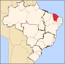
Jaguaribe Baixo JaguaribeAlto Santo · Ibicuitinga · Jaguaruana · Limoeiro do Norte · Morada Nova · Palhano · Quixeré · Russas · São João do Jaguaribe · Tabuleiro do NorteLitoral de AracatiMedio JaguaribeJaguaretama · Jaguaribara · JaguaribeSerra do PereiroMetropolitana de Fortaleza FortalezaPacajusHorizonte · PacajúsNoroeste Cearense CoreauIbiapabaCarnaubal · Croatá · Guaraciaba do Norte · Ibiapina · São Benedito · Tianguá · Ubajara · Viçosa do CearáIpuLitoral de Camocim e AcarauAcaraú · Barroquinha · Bela Cruz · Camocim · Chaval · Cruz · Granja · Itarema · Jijoca de Jericoacoara · Marco · Martinópole · MorrinhosMeruocaAlcântaras · MeruocaSanta QuiteriaCatunda · Hidrolândia · Santa QuitériaSobralNorte Cearense Baixo CuruParacuru · Paraipaba · São Gonçalo do AmaranteBaturiteAcarapé · Aracoiaba · Aratuba · Baturité · Capistrano · Guaramiranga · Itapiúna · Mulungu · Pacoti · Palmácia · RedençãoCanindeCascavelChorozinhoItapipocaMedio CuruUruburetamaItapagé · Tururu · Umirim · UruburetamaSertoes Cearenses Sertao de CrateusArarendá · Crateús · Independência · Ipaporanga · Monsenhor Tabosa · Nova Russas · Novo Oriente · Quiterianópolis · TamborilSertao de InhamunsSertao de QuixeramobimSertao de Senador PompeuAcopiara · Deputado Irapuan Pinheiro · Milhã · Mombaça · Pedra Branca · Piquet Carneiro · Senador Pompeu · SolonópoleSul Cearense BarroBrejo SantoCaririBarbalha · Crato · Jardim · Juazeiro do Norte · Missão Velha · Nova Olinda · Porteiras · Santana do CaririCaririacuAltaneira · Caririaçú · Farias Brito · GranjeiroChapada do AraripeAraripe · Assaré · Campos Sales · Potengi · SalitreCategories:- Municipalities of Brazil
- Ceará geography stubs
- Populated places in Ceará

Wikimedia Foundation. 2010.