- Mondrabet
-
Mondrabet — Village — Location in New Britain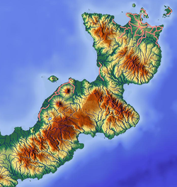
 Mondrabet
Coordinates: 4°43′35″S 151°45′10″E / 4.72639°S 151.75278°ECoordinates: 4°43′35″S 151°45′10″E / 4.72639°S 151.75278°E Country  Papua New Guinea
Province East New Britain Province Mondrabet is a large village on the island of New Britain, East New Britain Province, Papua New Guinea.[1] The village lies in the southwestern part of the Gazelle Peninsula, to the east of coastal village of Torin, upstream along the Torin River near its confluence with another river.[2] It is also connected by dirt road to Matanakunai on the coast in the southwest.
References
- ^ Peterson, Boyd D.; Garren, William R.; Heyda, Charles M.; United States. Defense Mapping Agency, United States Board on Geographic Names (1982). Gazetteer of Papua New Guinea: names approved by the United States Board on Geographic Names. Defense Mapping Agency. p. 343. http://books.google.com/books?id=ZPdCAQAAIAAJ. Retrieved 2 November 2011.
- ^ Google Maps. Maps (Map).
Categories:- Populated places in East New Britain Province
- Papua New Guinea geography stubs

Wikimedia Foundation. 2010.