- Moléson
-
Moléson 
Elevation 2,002 m (6,568 ft) Prominence 512 m (1,680 ft) [1] Parent peak Rochers de Naye Location  Switzerland
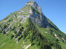
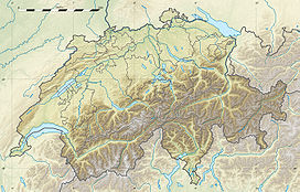
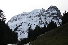
Range Bernese Alps Coordinates 46°32′55.6″N 7°1′1.7″E / 46.548778°N 7.017139°ECoordinates: 46°32′55.6″N 7°1′1.7″E / 46.548778°N 7.017139°E The Moléson (2,002 metres) is a mountain in the Alps in Switzerland (Fribourg Canton). A cable car station is located near the summit at 1,982 metres as well as a meteorological station.
Weather
Climate data for Le-Moléson Month Jan Feb Mar Apr May Jun Jul Aug Sep Oct Nov Dec Year Average high °C (°F) −1.4
(29.5)−1.6
(29.1)−0.8
(30.6)1.4
(34.5)5.8
(42.4)9.3
(48.7)12.3
(54.1)12.1
(53.8)10.1
(50.2)7.5
(45.5)2.6
(36.7)0.1
(32.2)4.8 Daily mean °C (°F) −4
(25)−4.1
(24.6)−3.3
(26.1)−1
(30)2.9
(37.2)6.4
(43.5)9.2
(48.6)8.8
(47.8)7.1
(44.8)4.6
(40.3)−0.2
(31.6)−2.7
(27.1)2 Average low °C (°F) −6.7
(19.9)−6.8
(19.8)−5.7
(21.7)−3.4
(25.9)0.6
(33.1)3.8
(38.8)6.3
(43.3)6.3
(43.3)4.6
(40.3)2
(36)−2.9
(26.8)−5.4
(22.3)−0.6 Precipitation mm (inches) 58
(2.28)76
(2.99)74
(2.91)84
(3.31)92
(3.62)96
(3.78)97
(3.82)100
(3.94)69
(2.72)71
(2.8)87
(3.43)79
(3.11)983
(38.7)Avg. precipitation days 9.6 9.6 11.9 12 13.7 13.2 11 11 8.6 8 9.4 10.3 128.3 Source: MeteoSchweiz [2] External links
References
- ^ Swisstopo maps (estimated)
- ^ "Temperature and Precipitation Average Values-Table, 1961-1990" (in German, French, Italian). Federal Office of Meteorology and Climatology MeteoSwiss. http://www.meteoswiss.admin.ch/web/de/klima/klima_schweiz/tabellen.html. Retrieved 8 May 2009.
Categories:- Bernese Alps
- Mountains of the Alps
- Mountains of Switzerland
- Switzerland geography stubs
Wikimedia Foundation. 2010.


