- Mokronog
-
Mokronog  Location in Slovenia
 Mokronog
Coordinates: 45°56′33.29″N 15°8′56.25″E / 45.9425806°N 15.1489583°ECoordinates: 45°56′33.29″N 15°8′56.25″E / 45.9425806°N 15.1489583°E Country  Slovenia
Traditional region Lower Carniola Statistical region Southeast Slovenia Municipality Mokronog-Trebelno Area - Total 11.73 km2 (4.5 sq mi) Elevation 255.8 m (839 ft) Population (2002) - Total 700 [1] Mokronog is a settlement in the Municipality of Mokronog-Trebelno in southeastern Slovenia. It is also the administrative centre of the municipality. The area is part of the historical region of Lower Carniola. The municipality is now included in the Southeast Slovenia statistical region.[2]
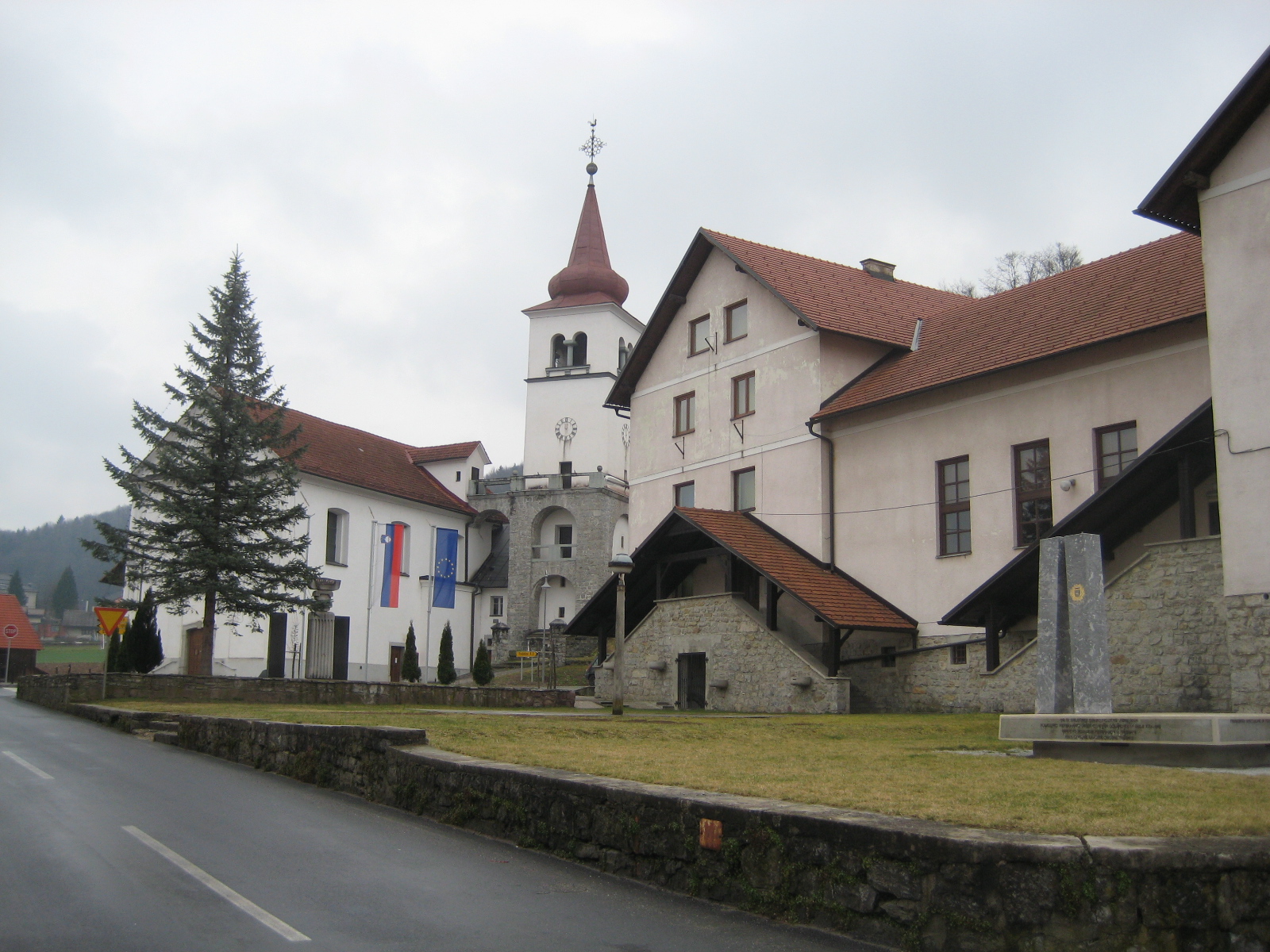
The parish church in the settlement is dedicated to Saint Giles (Slovene: Sveti Egidij) and belongs to the Roman Catholic Diocese of Novo Mesto. It was built in 1815 on the site of an older church.[3] A second church in the northern part of the settlement is dedicated to Saint Florian. It dates to the mid 17th century.[4]
A 13th-century castle with 15th-, 17th-, and 18th-century additions, built on a hill to the south of the parish church was burned down by the Yugoslav partisans after the capitulation of Italy in 1943[5] and further demolished after the Second World War.[6]
References
- ^ Statistical Office of the Republic of Slovenia
- ^ Mokronog-Trebelno municipal website
- ^ "EŠD 2051" (in Slovene). Registry of Immovable Cultural Heritage. Ministry of Culture of the Republic of Slovenia. http://giskd2s.situla.org/rkd/Opis.asp?ESD=2051&submit.x=0&submit.y=0. Retrieved 29 April 2011.
- ^ "EŠD 2052" (in Slovene). Registry of Immovable Cultural Heritage. Ministry of Culture of the Republic of Slovenia. http://giskd2s.situla.org/rkd/Opis.asp?ESD=2052&submit.x=0&submit.y=0. Retrieved 29 April 2011.
- ^ Savnik, Roman, ed. 1971. Krajevni leksikon Slovenije, vol. 2. Ljubljana: Državna založba Slovenije. p. 614.
- ^ "EŠD 27211" (in Slovene). Registry of Immovable Cultural Heritage. Ministry of Culture of the Republic of Slovenia. http://giskd2s.situla.org/rkd/Opis.asp?ESD=27211&submit.x=0&submit.y=0. Retrieved 29 April 2011.
External links
Mokronog-Trebelno Settlements Administrative Centre: Mokronog
Beli Grič, Bitnja vas, Bogneča vas, Brezje pri Trebelnem, Brezovica pri Trebelnem, Bruna vas, Cerovec pri Trebelnem, Cikava, Dolenje Laknice, Dolenje Zabukovje, Drečji Vrh, Češnjice pri Trebelnem, Čilpah, Čužnja vas, Gorenja vas pri Mokronogu, Gorenje Laknice, Gorenje Zabukovje, Gorenji Mokronog, Hrastovica, Jagodnik, Jelševec, Križni Vrh, Log, Maline, Martinja vas pri Mokronogu, Mirna vas, Most, Ornuška vas, Ostrožnik, Podturn, Pugled pri Mokronogu, Puščava, Radna vas, Ribjek, Roje pri Trebelnem, Slepšek, Srednje Laknice, Sveti Vrh, Štatenberk, Trebelno, Velika Strmica, Vrh pri TrebelnemCategories:- Populated places in the Municipality of Mokronog-Trebelno
- Jugovzhodna Slovenija statistical region geography stubs

Wikimedia Foundation. 2010.