Mohave Mountains

Mohave Mountains
Mohave Mountains
Mountain Range
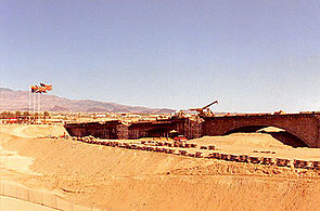
View looking southwest, south portion of Mohave Mountains
Country United States
State Arizona
Region (southeast)-Mojave Desert
(northwest)-Sonoran Desert
Municipality Mohave County, Arizona
Borders on Colorado River w/ Lake Havasu-W
Sacramento Valley & Wash-NW
Dutch Flat (Arizona)-NE & E
Bill Williams Mountains-SE
City Lake Havasu City, AZ
River Colorado River
Coordinates 34°38′18″N 114°23′17″W / 34.638342°N 114.388013°W / 34.638342; -114.388013
Highest point Crossman Peak
 - elevation 5,103 ft (1,555 m)
Length 15 mi (24 km), NW-SE
Width 6 mi (10 km)
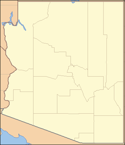
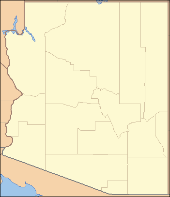
location of Mohave Mountains of Arizona


The Mohave Mountains is a small mountain range of northwest Arizona, in the southwest of Mohave County. The northwest area surrounding the range borders the south-flowing Colorado River and the Topock Gorge. The southwest border of the range is Lake Havasu City on the Colorado, where the London Bridge was reconstructed at Lake Havasu.

The high point of the range is Crossman Peak at 5,103 feet (1,555 m).[1]

References

  1. ^ Arizona Mountain Ranges [1]

External links


Wikimedia Foundation. 2010.

Игры ⚽ Нужна курсовая?

Look at other dictionaries:

  • Mohave Mountains — Sp Mohãvių kalna Ap Mohave Mountains L JAV (Arizona) …   Pasaulio vietovardžiai. Internetinė duomenų bazė

  • Mohave Valley — For the Arizona city in the Mohave Valley, Lower Colorado River, see Mohave Valley, Arizona. Coordinates: 34°57′25″N 114°35′5″W / 34.95694°N 114.58472°W …   Wikipedia

  • Mohave War — Part of the American Indian Wars Mohave Indians by H.B. Mollhansen, 1856 …   Wikipedia

  • Mohave County, Arizona — Mohave County Courthouse in Kingman, Arizona …   Wikipedia

  • Mohave County — Courthouse und Gefängnis in Klingman, gelistet im NRHP Nr. 83002990[1] Verwaltung U …   Deutsch Wikipedia

  • Mohave-Wüste — Mojave Wüste: Pinnacles National Natural Landmark Die Mojave Wüste (Mojave Desert), auch bekannt als Mohave Wüste, ist eine Wüste im Westen Nordamerikas. Sie umfasst 35.000 km² auf dem Gebiet der US Bundesstaaten Kalifornien, Utah, Nevada und… …   Deutsch Wikipedia

  • Mohave —  , Mojave  The first is the spelling for the Native American tribe and mountains in Arizona; the second is the spelling of the desert …   Bryson’s dictionary for writers and editors

  • Chemehuevi Mountains — Coordinates: 34°37′30.031″N 114°31′32.863″W / 34.62500861°N 114.52579528°W / 34.62500861; 114.52579528 …   Wikipedia

  • Dead Mountains — This article is about the mountain range in California. For the mountain range in Austria, see Totes Gebirge. Coordinates: 35°1′40.002″N 114°44′55.891″W / 35.0277 …   Wikipedia

  • El Dorado Mountains — Geobox|Range name=El Dorado Mountains image size= image caption= country=United States state=Arizona geology=|orogeny= highest=Iretaba Peak highest elevation imperial=5060 map caption=The El Dorado Mountains is a north south trending mountain… …   Wikipedia

Share the article and excerpts

Direct link
Do a right-click on the link above
and select “Copy Link”