- Mode, Illinois
-
Mode, Illinois — Unincorporated community — 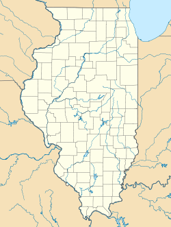
 Mode, Illinois
Coordinates: 39°15′59″N 88°44′01″W / 39.26639°N 88.73361°WCoordinates: 39°15′59″N 88°44′01″W / 39.26639°N 88.73361°W Country United States State Illinois County Shelby Elevation 623 ft (190 m) Time zone Central (CST) (UTC-6) - Summer (DST) CDT (UTC-5) ZIP code 62444 Area code(s) 217 GNIS feature ID 413695[1] Mode is an unincorporated community in Shelby County, Illinois, United States. Mode is 5.5 miles (8.9 km) west of Stewardson. Mode has a post office with ZIP code 62444.[2]
References
- ^ "US Board on Geographic Names". United States Geological Survey. 2007-10-25. http://geonames.usgs.gov. Retrieved 2008-01-31.
- ^ ZIP Code Lookup
Municipalities and communities of Shelby County, Illinois County seat: Shelbyville Cities 
Towns Villages Cowden | Findlay | Herrick | Mowequa‡ | Oconee | Stewardson | Strasburg | Tower Hill
Townships Ash Grove | Big Spring | Clarksburg | Cold Spring | Dry Point | Flat Branch | Herrick | Holland | Lakewood | Moweaqua | Oconee | Okaw | Penn | Pickaway | Prairie | Richland | Ridge | Rose | Rural | Shelbyville | Sigel | Todds Point | Tower Hill | Windsor
Unincorporated
communitiesDollville | Duvall | Fancher | Henton | Herborn | Hinton | Kingman | Lakewood | Middlesworth | Mode | Westervelt | Yantisville
Footnotes ‡This populated place also has portions in an adjacent county or counties
Categories:- Populated places in Shelby County, Illinois
- Unincorporated communities in Illinois
- Illinois geography stubs

Wikimedia Foundation. 2010.