- Milevska Planina
-
Milevska planina 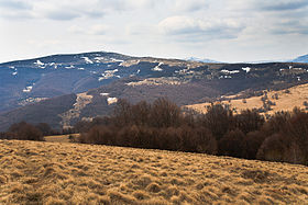
View towards Milevska Planina's highest peak from the Bulgarian sideElevation 1,738 m (5,702 ft) [1] Location Location within Bulgaria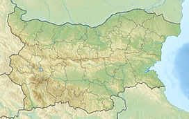
 Milevska planina
Location Pčinja District, Serbia Coordinates 42°33′54″N 22°26′22″E / 42.565°N 22.43944°ECoordinates: 42°33′54″N 22°26′22″E / 42.565°N 22.43944°E Milevska planina[1] (Cyrillic: Милевска планина) is a mountain in southeastern Serbia and western Bulgaria, near the town of Bosilegrad. Its highest peak Milevets (Bulgarian: Милевец) or Krvavi kamik has an altitude of 1738 meters above sea level. It is located at the border of two countries.
References
- ^ a b Jovan Đokić. "Katalog planina Srbije". PSD Kopaonik Beograd. http://www.psd-kopaonik.org.rs/03KatalogplaninaSrbije.html.
Categories:- Mountains of Serbia
- Mountains of Bulgaria
- Serbia geography stubs
- Bulgaria geography stubs


Wikimedia Foundation. 2010.