- Micoud, Saint Lucia
-
Micoud Political map of St Lucia showing location of Micoud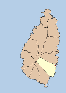
Coordinates: 13°49′08″N 60°54′00″W / 13.819°N 60.900°W Country  Saint Lucia
Quarter Micoud Quarter Founded 18th Century Founder The French Named for Baron de Micoud, governor of Saint Lucia Government - Governing body Micoud Village Council Elevation[1] 1 m (3 ft) Population (2005)[2] - Total 16,620 (Micoud District) Time zone Eastern Caribbean Time Zone (ECT) (UTC-4) Area code(s) 758 Micoud is a village of around 2,700 inhabitants situated on the east coast of Saint Lucia. It was named after Baron de Micoud, who was the French governor of Saint Lucia in the 18th Century.
More recently it has been known as the home town and constituency seat of Sir John Compton, who was the Premier of Saint Lucia from 1967-1979, then Prime Minister in 1979, 1982-1996 and 2006-2007.
Categories:- Saint Lucia geography stubs
- Towns in Saint Lucia

Wikimedia Foundation. 2010.