Michoud, New Orleans

Michoud, New Orleans
Old plantation smokestacks stand outside one of the buildings of NASA's Michoud Assembly Facility.

Michoud [MĒĒ-shū] is an area in Eastern New Orleans, part of the Ninth Ward of New Orleans, Louisiana, located at latitude 30.03N, longitude -89.925W.

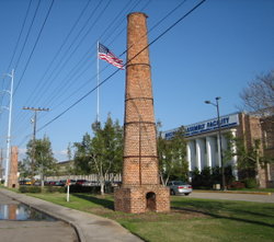
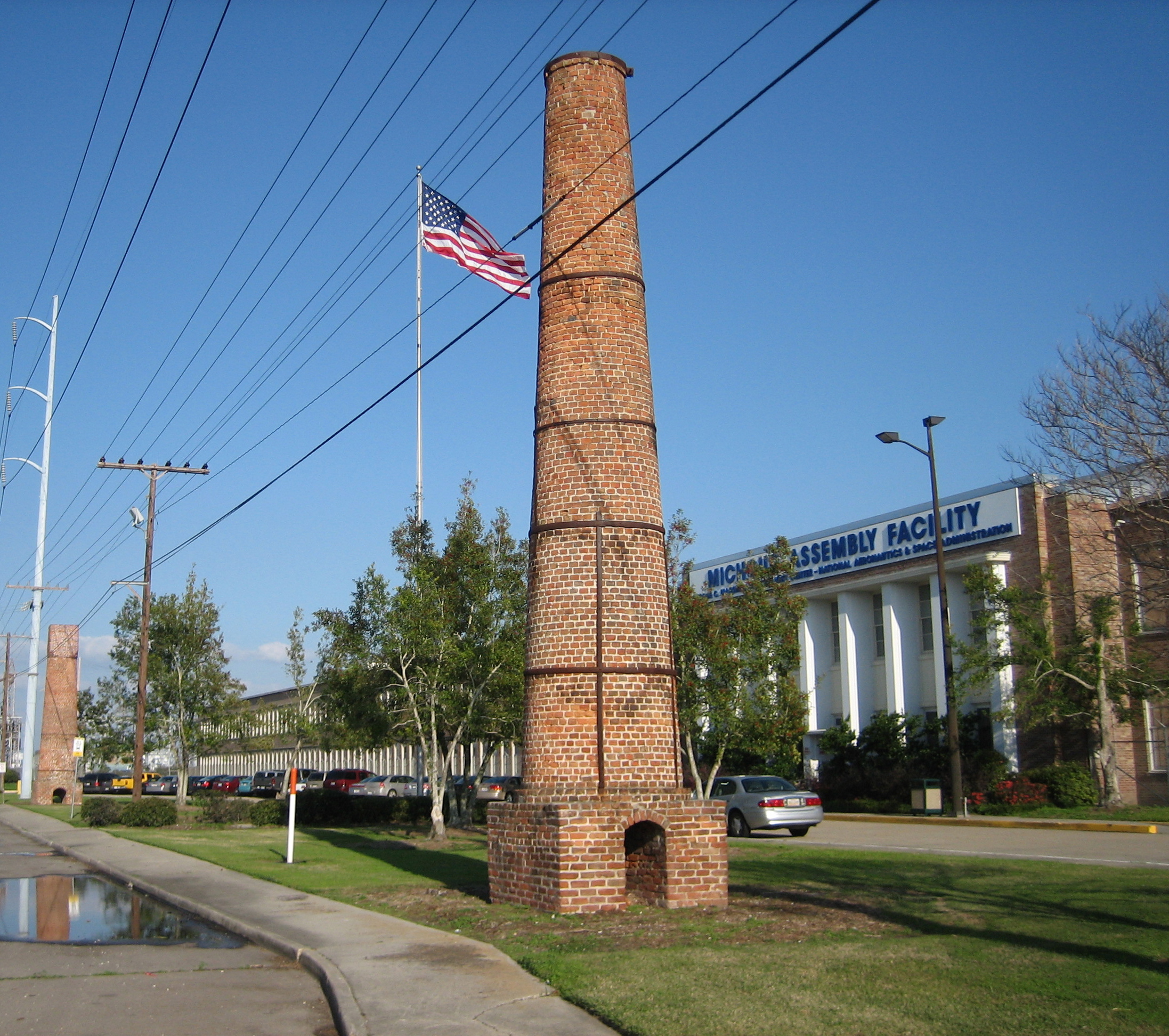
In the 19th century Michoud was a small rural village in Orleans Parish outside of the city limits on Gentilly Road. Before the American Civil War a sugar plantation and refinery was located here; the old brick smokestacks still remain as an area landmark beside Gentilly Road. After the construction of the Gulf Intracoastal Waterway some industrial development of the area began, growing with military plants during World War II, most importantly Higgins Industries factories. A small military airfield was here in the 1940s and 1950s [1].

Today Michoud is best known as the location of NASA's Michoud Assembly Facility. This area has the distinction of being the fastest-sinking part of Louisiana, and one of the fastest-sinking areas of the Gulf Region. It is also among the lowest areas in the city, in terms of elevation.

See also


External links


Wikimedia Foundation. 2010.

Игры ⚽ Нужно сделать НИР?

Look at other dictionaries:

  • New Orleans — New Orleanian /awr lee nee euhn, leen yeuhn/. /awr lee euhnz, awr leenz , awr leuhnz/ a seaport in SE Louisiana, on the Mississippi: British defeated (1815) by Americans under Andrew Jackson. 557,482. * * * City (pop., 2000: 484,674),… …   Universalium

  • New Orleans — The Big Easy and NOLA redirect here. For other uses, see The Big Easy (disambiguation) and NOLA (disambiguation). This article is about the city. For other uses, see New Orleans (disambiguation). City of New Orleans Ville de La Nou …   Wikipedia

  • New Orleans, Louisiana — Infobox Settlement official name = City of New Orleans native name = Ville de La Nouvelle Orléans nickname = The Crescent City, The Big Easy, The City That Care Forgot, Nawlins, and NOLA (acronym for New Orleans, LA). website =… …   Wikipedia

  • Eastern New Orleans — is a large section of the city of New Orleans, Louisiana. Developed extensively from the 1960s onwards, it was originally marketed as suburban style living within the city limits , and has much in common with the Algiers neighborhood of New… …   Wikipedia

  • NAACP New Orleans Branch — New Orleans Branch of the National Association for the Advancement of Colored People Abbreviation NAACP New Orleans Branch Formation July 15, 1915 Purpose/focus To ensure the political, educational …   Wikipedia

  • Ninth Ward of New Orleans — The Ninth Ward or 9th Ward is a distinctive region of New Orleans, Louisiana that is located in the easternmost downriver portion of the city. It is geographically the largest of the 17 Wards of New Orleans. On the south the Ninth Ward is bounded …   Wikipedia

  • Neighborhoods in New Orleans — In 1980 the New Orleans City Planning Commission divided the city into 13 planning districts and 72 distinct neighborhoods. While most of these assigned boundaries match with traditional local designations, some others differ from common… …   Wikipedia

  • Orleans Parish — Skyline von New Orleans Verwaltung US Bundesstaat: Louisiana …   Deutsch Wikipedia

  • Michoud — Die alten Schornsteine der Plantage stehen außerhalb eines der Gebäude der NASA Michoud Assembly Facility Lage in Louisiana …   Deutsch Wikipedia

  • Michoud, Louisiana — Michoud [MĒĒ shū] is an area in Eastern New Orleans, part of the Ninth Ward of New Orleans, Louisiana, located at latitude 30.03N, longitude 89.925W. In the 19th century Michoud was a small rural village in Orleans Parish outside of the city… …   Wikipedia

Share the article and excerpts

Direct link
Do a right-click on the link above
and select “Copy Link”