- Expo Phase 2 (Los Angeles Metro)
-
 Expo Phase 2
Overview Type light-rail (LRT) System Los Angeles County Metro Rail Status Under construction Locale Los Angeles Termini Culver City
4th/ColoradoOperation Opened 2015 (expected) Operator(s) Los Angeles County Metropolitan Transportation Authority (Metro) The Metro Rail Exposition Corridor, Phase 2 (frequently referenced as Expo Phase 2) is a mass-transit project to extend the light-rail Expo corridor as part of the Los Angeles County Metro Rail System.[1] The corridor extension will connect Culver City to Santa Monica, mostly along the Exposition Boulevard right-of-way. It extends the corridor built by the Expo Phase 1 project.
When completed, the Expo corridor will be served by the Metro Expo Line. The project is sponsored by the Los Angeles County Metropolitan Transportation Authority, and is being implemented by the Exposition Metro Line Construction Authority (or Expo Authority).[2] Skanska/Rados, a joint venture, is the design-build contractor.
Expo Phase 2 is expected to be completed in 2015.
Contents
Environmental review process
Draft environmental study
The environmental-impact study for Phase 2 began with a brand-new draft environmental-impact study in November 2006, with Metro's award for the contract for the study. Metro completed a series of public meetings throughout 2007, to study the Phase 2 corridor and review all feasible alternatives. In October 2007, Expo Authority began an initial environmental study for Expo Phase 2. The study looked at six alternatives: no-build, Transportation Systems Management (TSM) and four build alternatives: [3]
-
- LRT 1: Expo ROW - Olympic
- LRT 2: Expo ROW - Colorado
- LRT 3: Venice/Sepulveda - Olympic
- LRT 4: Venice/Sepulveda - Colorado
Each of these build alternatives uses the Exposition right-of-way (ROW) for most of its route. The four build alternatives reflect the different combinations of two alignment options.
The first alignment option defines the route from the Phase 1 terminus at Culver City to the station at Sepulveda/Exposition. Alternatives LRT 1 and LRT 2 both use the existing Exposition rail right-of-way (ROW). This ROW begins south of the 10 Freeway, and then moves to the north side of the freeway through Rancho Park before reaching Sepulveda Boulevard. Alternatives LRT3 and LRT4 use an elevated route located in the median of Venice Boulevard and Sepulveda Boulevard.
The second alignment option defines the west end of the corridor, west of Olympic/Exposition in Santa Monica. Alternatives LRT 1 and LRT 3 follow Olympic Boulevard for this portion of the route. Alternatives LRT 2 and LRT 4 continue west on Exposition, joining Colorado Avenue at 19th Street and continuing west in the median of Colorado Avenue to the final terminus in Downtown Santa Monica.
The following table summarizes the findings in the DEIR study.[4]
Alternative Length
(miles)Daily Boardings Estimated cost
(DEIR)Estimated cost
(FEIR [5])FTA cost
effectivenessLRT 1 Expo ROW - Olympic 6.6 36,653 $.97 billion $1.35 billion $20.21 LRT 2 Expo ROW - Colorado 6.6 36,412 $.93 billion $1.30 billion $20.01 LRT 3 Venice/Sepulveda - Olympic 7.6 35,880 $1.43 billion $1.83 billion $32.76 LRT 4 Venice/Sepulveda - Colorado 7.6 35,849 $1.39 billion $1.78 billion $32.23
All of the build alternatives were expected to generate similar numbers of daily boardings. However, the Venice/Sepulveda alternatives (Alt 3 and Alt 4) were found to be much more expensive, and to increase travel time significantly. Therefore, Alternatives 1 and 2 were selected for further study in the final environmental study. The Draft Environmental Impact Report (DEIR) was completed in January 2009, and was approved by the Expo Authority in April 2009.[6]Final environmental study
The final environmental study began in mid-2009. This study conducted additional studies on the No-Build and TSM alternatives, as well as Alternatives 1 and 2.[5] The Final Environmental Impact Report (FEIR) was completed in December 2009.
The cost estimates for the project escalated dramatically between the DEIR and the FEIR (see table above). The changes were attributed to additional refinements and features identified during the FEIR process, as well as new cost estimates which better reflect local cost information.[5]
The Expo Authority Board selected LRT 2 as the final selected alternative by on 4 February 2010.[7] This selection followed the recommendation in the FEIR, which stated that LRT 2 "would provide high ridership, a competitive travel time, less community disruption, and the least relocation of residents, with the most cost effective price."[5] In addition, LRT 2 had greater support from the public, as well as from the City of Santa Monica.
Grade crossing controversy
The grade crossings in Rancho Park (at Overland Avenue, Westwood Boulevard and Military Avenue) are controversial. Some neighbors believe these crossings will be unsafe and will negatively impact their neighborhood.
Setting
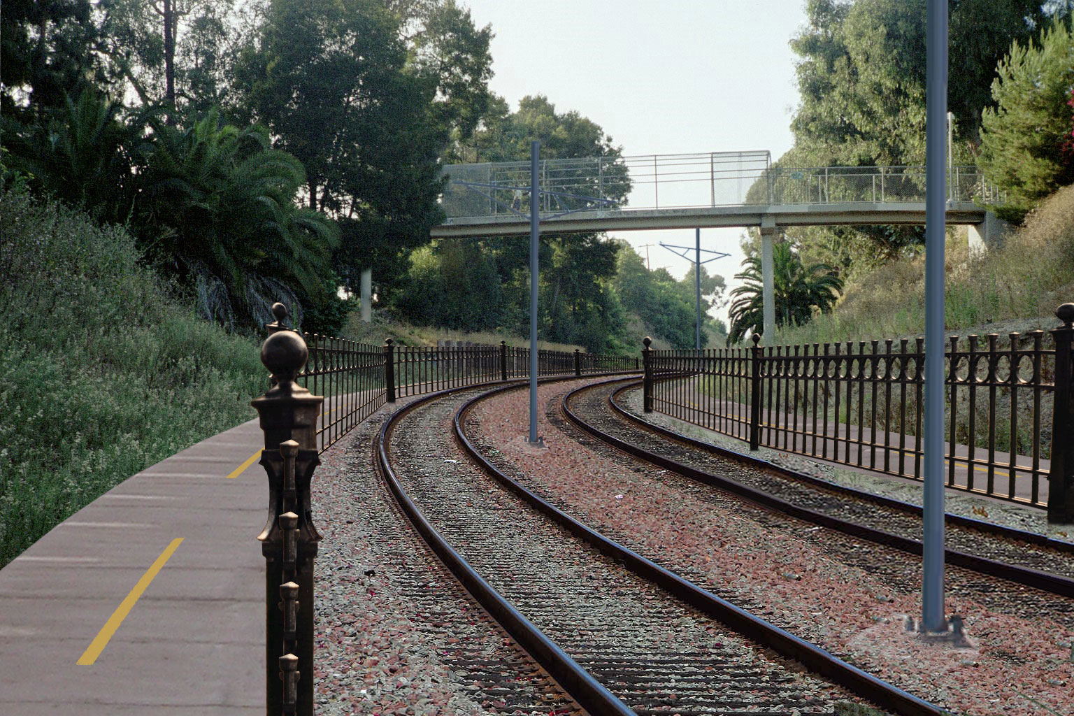
 Artist's concept of the Metro Expo Line grade-separated transit parkway adjacent to Northvale Road in Rancho Park (concept overlaid on actual photograph).
Between the freeway underpass and Overland Ave, the right-of-way is sunk in a preexisting trench, next to Northvale Rd (formerly, Exposition Blvd), surrounded by dense foliage. This trench was built in the early days of the railroad in 1875 to level the tracks through the slopes of Cheviot Hills.
West of Overland, the right-of-way continues at-grade, crossing Westwood Boulevard and Military Avenue. Expo Phase 2 will include an at-grade station between Overland Avenue and Westwood Boulevard along the ROW.
The ROW cuts through Rancho Park, a quiet, well-kept neighborhood of single-family homes , and passes along the edge of Cheviot Hills, a wealthy residential neighborhood to the northeast.[8][9] The northern edge of both neighborhoods is busy Pico Boulevard, which separates them from Westwood and Century City, major job centers and dense residential neighborhoods. The Santa Monica Freeway (Interstate 10) borders both neighborhoods on the south. The combination of the freeway and the dense job centers results in very heavy traffic on Westwood and Overland.
Support for grade crossings
To determine which crossings to grade-separate along the route, Expo applied Metro's Grade Crossing Policy For Light Rail Transit.[10] This policy was adopted by Metro to provide a rational and consistent process for determining when to grade-separate crossings. The process involves applying a set of criteria to each crossing through three stages of evaluation: initial screening, detailed analysis, and verification.
Expo conducted this process for determining which crossings to grade-separate: the results are listed in the table of grade crossings above.
For the three crossing at issue, Expo determined the following: [11]
-
- Military Ave was determined to be appropriate for a crossing at-grade from the initial screening.
-
- Westwood Blvd was initially flagged for further analysis. According to Expo's study, current conditions at Westwood/Exposition have a "level-of-service" (traffic congestion) at "F" (on a scale of A through F). However, Expo believes that with its planned mitigations, the intersection could have its level-of-service improved to "B" in 2030. These mitigations include removal of some street parking.
-
- Overland Ave was initially flagged for further analysis. According to Expo's study, current conditions at Overland/Exposition have a level-of-service at "B/C". Expo believes that with its planned mitigations, the intersection could maintain this level-of-service in 2030. These mitigations include addition of an extra traffic lane in each direction on Overland and removal of some street parking.
Thus, application of the Grade Crossing Policy led to Expo's conclusion that a grade-separation is not necessary at these three crossings. The cost and difficulty of grade separation at these crossings was a key argument in not pursuing this option.
Expo's position is supported by transit advocacy groups.[12][13] as well as some nearby residents [14]
Opposition to grade crossings
Neighbors For Smart Rail (NFSR) is leading the opposition to the grade crossings in Rancho Park. On its website, NFSR makes the following claims about the current plan: [15]
-
- Expo will create a "traffic wall".
- Expo will pose safety risks to students.
- Expo will result in loss of privacy for many homes.
- Expo will create vibration and noise.
- Expo will bring crime to the neighborhood.
- Expo will result in loss of trees.
- Expo will miss the dense job centers.
- The Metro Grade Crossing Policy is a fraud.
NFSR claims support from home owners in the surrounding areas of Cheviot Hills, West of Westwood, and Westwood Gardens.[16][17][18][19]
Resolution
In Spring 2010, an organization opposing the grade crossings, Neighbors For Smart Rail (NFSR) filed a lawsuit in Superior Court against the Expo Authority and the FTA, seeking to halt Expo Phase 2 until these and other related issues are addressed.[20] In February 2011, the judge issued a judgement denying the petition. [21] In late 2011, the Public Utilities commission certified all grade crossings for Expo Line Phase 2.
Selected alternative
Route
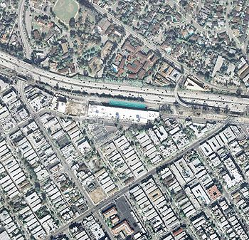
The selected route stretches 6.6 miles from an eastern terminus at Venice/Robertson in Culver City to a western terminus at 4th/Colorado in Santa Monica.
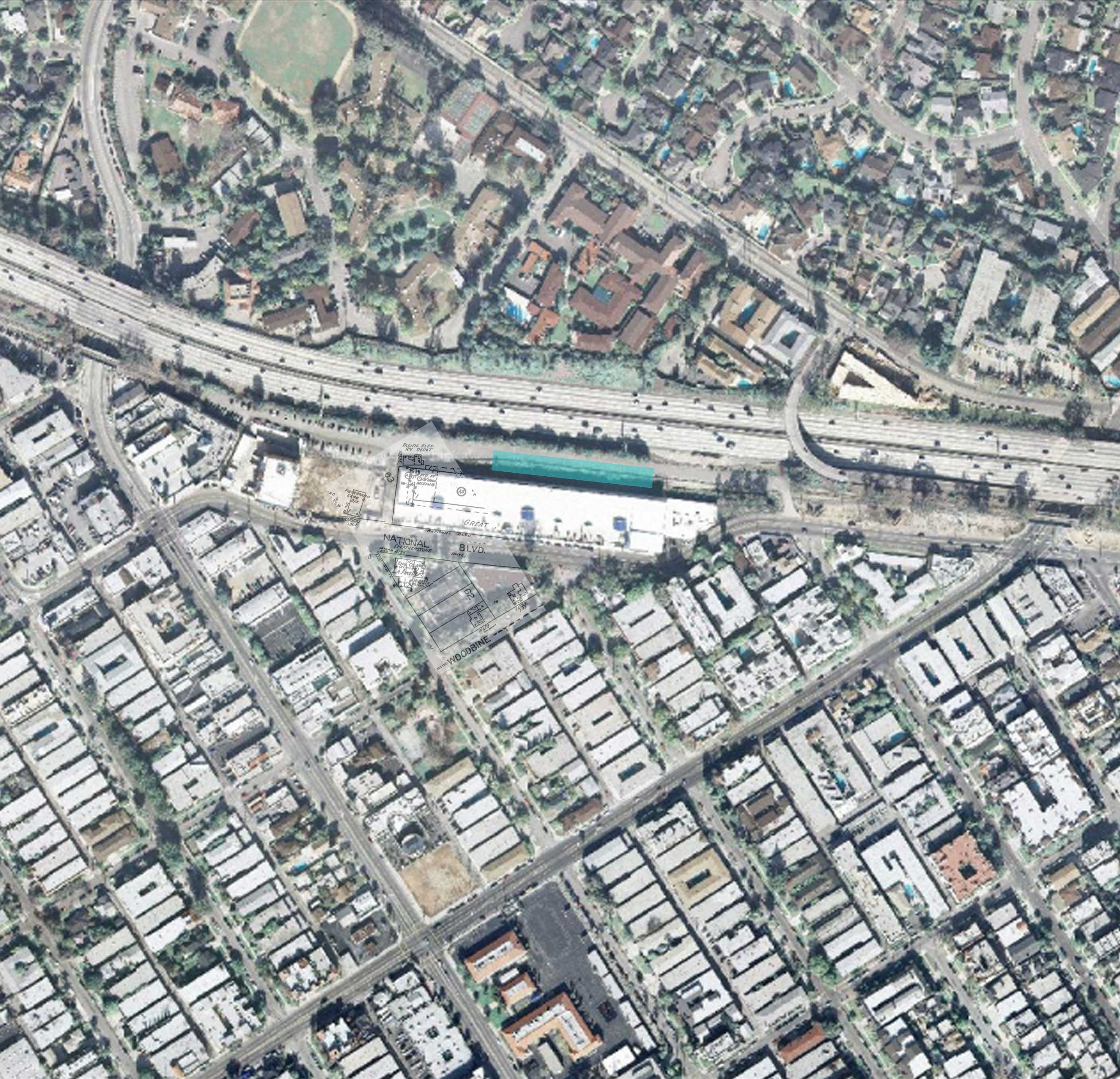
 1951-parcel-map overlay for Pacific Electric Railroad Palms Depot (Palms Station) of the Expo Line (then Santa Monica Air Line), shown along with the possible future station location (aqua rectangle).
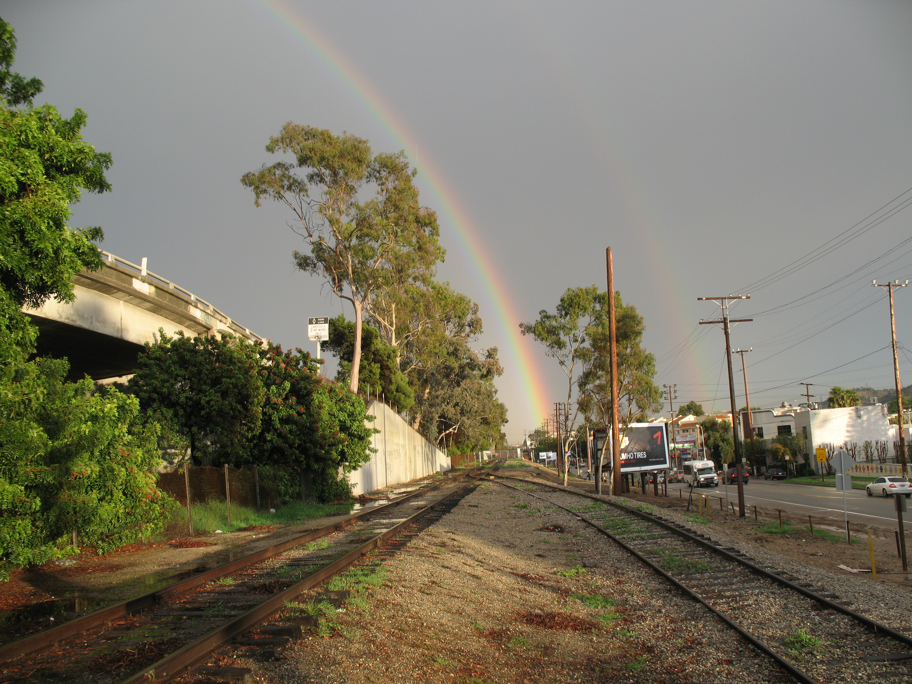
 Metro Expo Line Palms Station under rainbow before construction.
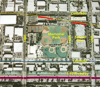 Colorado Ave alignment for the Metro Expo Line in Downtown Santa Monica.
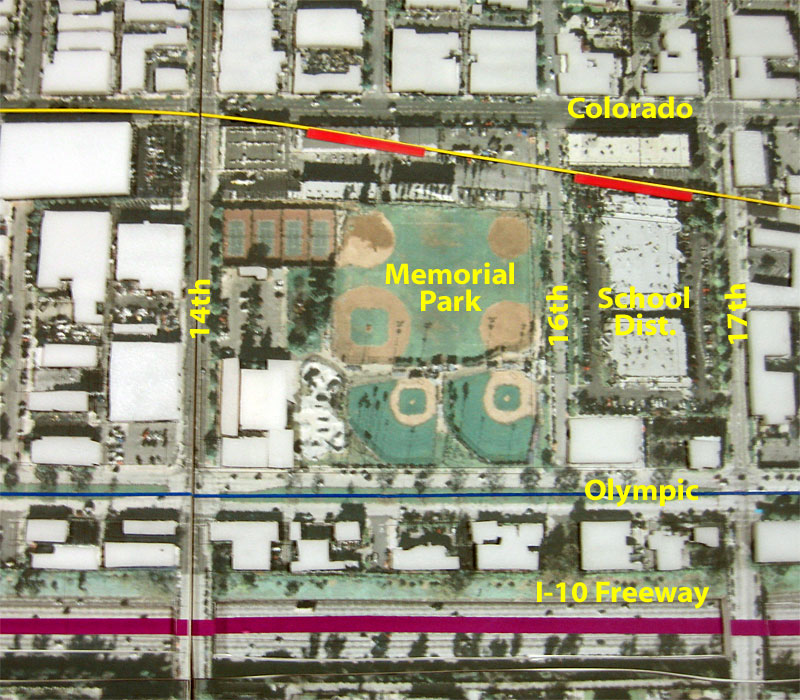
The westernmost station of Expo Phase 1 is Culver City station, in a location previously known as "Culver Junction". From here, Phase 2 heads west along the old Pacific Electric Santa Monica Air Line right-of-way (ROW). It passes first through densely populated Palms, and then under the 10 freeway into Rancho Park, a quiet, affluent suburban neighborhood just south of busy Pico Boulevard. Through Rancho Park, the ROW borders Cheviot Hills. This part of the ROW is a shortcut through street grid with few crossings, allowing it to run at higher speeds. (A video of this segment is found on YouTube.)
Coming out of Rancho Park, the route crosses Sepulveda at a location once known as "Home Junction". The route then follows the ROW under the 405 freeway and across West Los Angeles. Near Olympic and Cloverfield, the ROW passes Bergamot Station art facility and the Watergarden. The Exposition ROW ends at 17th St in Santa Monica. Finally, the corridor will follow the median of Colorado Ave to 4th Street in Santa Monica.
The route includes 7 stations:
-
- National/Palms
- Westwood/Expo
- Sepulveda/Expo
- Bundy/Expo
- Bergamot
- 17th/Colorado
- 4th/Colorado
Grade separations
The following table summarizes the grade crossings and grade separations along the ROW between Venice/Robertson and 15th/Colorado: [11]
Street Grade separation Venice Blvd bridge Bagley Ave - National Blvd bridge Motor Ave bridge I-10 Freeway undercrossing Overland Ave - Westwood Blvd - Military Ave - Sepulveda Blvd bridge* I-405 Freeway undercrossing Sawtelle Blvd bridge Pico Blvd/Gateway Blvd bridge Barrington Ave - Bundy Dr bridge Centinela Ave bridge Stewart St - 26th St - Cloverfield Blvd/Olympic Blvd bridge 20th St - 19th St - 17th St - * The FEIR did not require grade separation at Sepulveda, but included a design option for an elevated crossing and station should funds become available. Funds for the elevated station were approved by the L.A. City Council in March 2011, and the design option was approved by the Expo Board shortly thereafter.
Vehicle maintenance facility
Expo and the City of Santa Monica are finalizing plans for the Expo maintenance facility. It will be located adjacent to Bergamot station. This facility will perform shop-related activities, including servicing, cleaning, inspection and repair of LRT vehicles. It will also include a yard with a storage capacity of up to 45 LRT vehicles.[22]
Bicycle and pedestrian path
A bicycle path was originally planned for the entire Expo Line route. However, the project was split from the transit corridor into a separate project, in order to expedite the EIR process. Currently, there are two gaps in the proposed bike path. The first gap is between Palms/National Boulevards and Overland Ave, a distance of more than a mile. The second gap is between Sawtelle Blvd and north of Pico Blvd.
The first gap (between Palms and Rancho Park) is largely due to the narrowness of the tunnel through which the ROW passes. One possibility is to route it through the restricted-use easement on the northern edge of the freeway, which has plenty of space and is well-situated for a scenic trail. Another low-cost possibility is to create a bicycle bridge, like the Rosecrans Ave/Aviation Blvd Green Line bridge.
Project funding
The project is expected to cost approximately $1.3 billion. A budget will be prepared once a contractor bid has been chosen for the contract. The project is funded entirely by state and local funds, including Measure R.[23]
Planned service
The Expo Corridor (Phases 1 and 2) will be served by the Metro Expo Line. There are no plans to use the route for any other lines.
Construction
In March 2010, Expo selected two contractors, URS/Shimmick and Skanska/Rados, to complete preliminary engineering. These two contractors received the highest among five bids for the project.[24] One year later, in March 2011, the Expo Board approved a $542 million contract with Skanska/Rados. Construction of the line will begin later in 2011.[25]
References
- ^ Metro Rail Expo Corridor, Phase 2 to Santa Monica. Metro.net. Retrieved on 2010-11-26.
- ^ :: Expo Train ::. buildexpo.org. Retrieved on 2010-11-26.
- ^ Microsoft Word - ExpoPh2_DEIR_2009-01-28.doc. (PDF) . Retrieved on 2010-11-26.
- ^ :: Expo Line::. backup.buildexpo.org. Retrieved on 2010-11-26.
- ^ a b c d FEIR Executive summary
- ^ Expo Line board votes for Exposition Boulevard route - Los Angeles Times. Articles.latimes.com (2009-04-04). Retrieved on 2010-11-26.
- ^ Expo Authority Certifies Final Environmental Impact Report for Expo Line Extension to Santa Monica Action Greenlights Light Rail for the Congested Westside, buildexpo.org
- ^ Rancho Park Profile - Mapping L.A. - Los Angeles Times. Projects.latimes.com. Retrieved on 2010-11-26.
- ^ Cheviot Hills Profile - Mapping L.A. - Los Angeles Times. Projects.latimes.com. Retrieved on 2010-11-26.
- ^ Crossing for Light Rail Transit.pdf
- ^ a b Microsoft PowerPoint - Expo Phase 2 Grade Crossing Determinations PRESENTATION 6.13.08. (PDF) . Retrieved on 2010-11-26.
- ^ The Expo Line - Friends 4 Expo Transit Home Page. Friends4expo.org. Retrieved on 2010-11-26.
- ^ The National Transit Coalition. Transitcoalition.us. Retrieved on 2010-11-26.
- ^ Light Rail for Cheviot Hills. Lightrailforcheviot.org. Retrieved on 2010-11-26.
- ^  Neighbors for Smart Rail. Smartrail.org. Retrieved on 2010-11-26.
- ^ Cheviot Hills. Cheviot Hills. Retrieved on 2010-11-26.
- ^ West of Westwood HOA, 2010
- ^ Welcome to the Westwood Gardens Civic Association website
- ^ Tract 7260 Association - West Los Angeles, Century City, Development. Tract7260.org (2009-04-30). Retrieved on 2010-11-26.
- ^ Court Case BS 125233, Los Angeles County, California
- ^ Judgement, BS 125233
- ^ Project alternatives
- ^ Measure R. Metro.net. Retrieved on 2010-11-26.
- ^ Subject. (PDF) . Retrieved on 2010-11-26.
- ^ "Expo Line Phase 2 construction is a “go”". The Source (Metro blog). 21 March 2011. http://thesource.metro.net/2011/03/18/expo-line-phase-2-construction-is-a-go/. Retrieved 21 March 2011.
External links
- VIDEO: Los Angeles Metro Expo Line - Time-Lapse Tour of Phase II - Starting about 6 blocks West of Robertson & Venice through West LA to the corner of Pico & Sawtelle
- Exposition Metro Line Construction Authority—official Web site of the Expo Line
- Friends 4 Expo Transit—grassroots group in support of the Expo Line and careful analysis of both the right-of-way and Venice/Sepulveda alternatives
- Light-Rail for Cheviot—Cheviot Hills homeowners in support of the right-of-way alignment
- Expo Greenway—park with stream-daylighting concept envisioned for integration with the Expo Line in Rancho Park, advocated for by a neighbor
- Neighbors for Smart Rail—Rancho Park area residents in support of the Venice/Sepulveda Boulevards alignment and careful analysis of all possible alternatives
- Expo Communities United—opposition group voicing a need for below-grade (subway) alignment in Mid-City
- Citizens' Campaign to Fix the Expo Rail Line—opposition group voicing a need for below-grade (subway) alignment in Mid-City
Los Angeles County Metropolitan Transportation AuthorityMetro services Metro Bus
Major facilities Capital projects Expo Line (Phase 1 · Phase 2) • Foothill Extension • Crenshaw Line • Westside Subway Extension • Regional ConnectorOther information Bus fleet • Rail fleet • Transit Access Pass (TAP) • Transportation in Los AngelesCategories:- Los Angeles County Metro Rail projects
- Proposed public transportation in the United States
-
Wikimedia Foundation. 2010.